
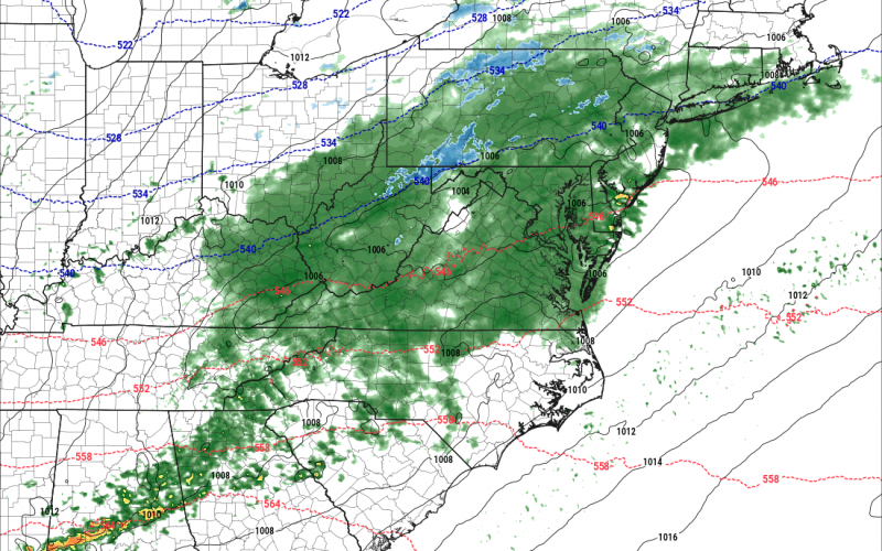
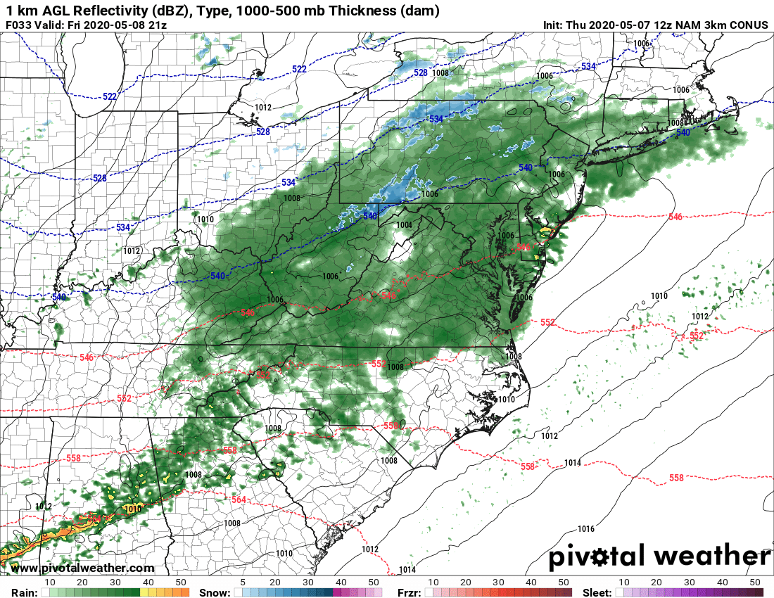
It will remain nice for the rest of Thursday with plentiful sunshine and high pressure. However clouds start to move back in for Friday, and we will see the return of rain once again, especially in the late afternoon. The rain will spread from west to east throughout the day. After the rain wraps up from west to east, windy conditions will follow which will bring in a very unusually cold airmass. Below is the future radar for 5 pm Friday. Some of the rain and showers could be gusty, so make sure to secure any loose outdoor objects. And yes, that is snow in the higher elevations of PA. The NAM is not nearly as gong-ho now as it was yesterday, so there is the possibility of a bust on the low end.
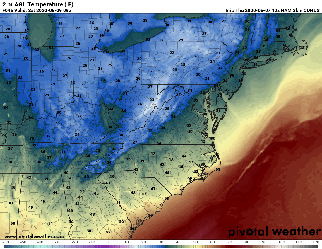
By Saturday morning, many of us will be in the 40s and 30s, and even 20s in the mountains! However, many of us in the Carolinas will remain in the upper 30s and low 40s, with the coastal areas seeing lows in the upper 40s. This is still unusual for May, even for the Southeast.
Projected early Saturday morning lows:
Everyone stay warm! And unfortunately it does not look like the chill will stop here, as it could continue for another week from now. We will keep you posted here at Carolina Weather Authority so please check back!
You must be logged in to post a comment.