
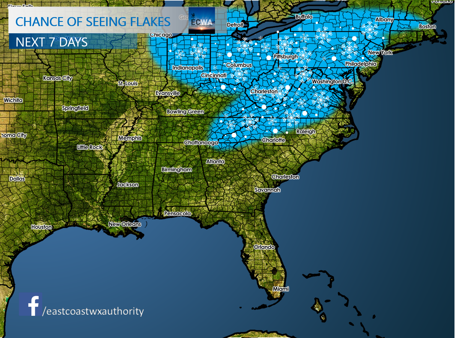
While there has been much snow talk here in the Southeast, there could be a some disappointments so don’t get your hopes up. The mountains of Western NC and up into PA will have the best chances for seeing the white stuff. When we say chance of seeing flakes, we mean seeing any snowflakes at all, and does NOT include accumulations. We think that while there is a chance, there is also a bust potential with this winter “event.” However, many people will see snowflakes even with no accumulations:
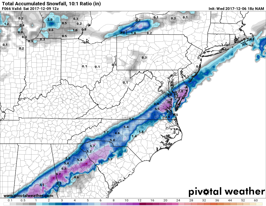
With that being said, many people will see the potential for the flakes flying late this week as well as hear sleet pinging on windows. Some models are putting down some pretty snow impressive totals. The the NAM, which has half a foot in spots into this weekend. This would be a significant winter storm from Atlanta to Richmond.
The GFS model currently has a bug with the snow output from NOAA. So we will skip that model here. That brings us to the Canadian. It absolutely buries many of us across the South. These totals also include sleet, so please keep that in mind. Sleet can cut into snow totals by several inches. Sometimes even by half.

We will certainly keep you updated as this story unfolds.
Follow us on Facebook for all the latest >>> https://www.facebook.com/eastcoastwxauthority
Also check out our new Winter Weather Page! >>> https://carolinawxauthority.com/winter-weather-page
-Mike G.
You must be logged in to post a comment.