
There is a Winter Weather Advisory in effect Sunday morning across western NC, upstate of SC, north Georgia, and western VA from 1am to 10am Sunday. Shown below is the map outlining the advisory.
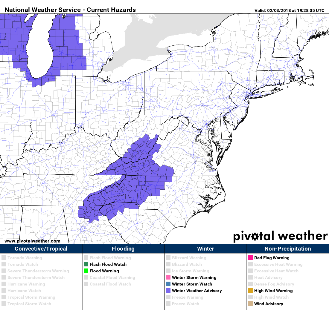
Anyone that has plans to venture out in the morning hours, and even early morning hours may have to reconsider as roads and walkways will become slippery and dangerous. Driving anytime during the advisory is not recommended. Even walking outside could turn treacherous as railings and sidewalks will become icy.
Nam high resolution model for 8am Sunday:
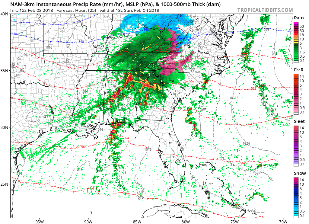
The pink in the model is freezing rain. It is expected to change over to all rain around lunchtime, or even in the early afternoon to be safe. If warmer air tries to pump in, then we can expect a changeover from ice to rain. However, if the warm air is delayed, then we can expect a potentially nasty situation across the western Carolinas as an ice storm would be possible.
The following model animation shows the trend of what kind of precip we can expect from Sunday morning into Sunday afternoon. Click on the image below for the animation.
The NWS in Greenville/Spartanburg, SC which covers Charlotte chimes in on the Winter Weather Advisory for Sunday:
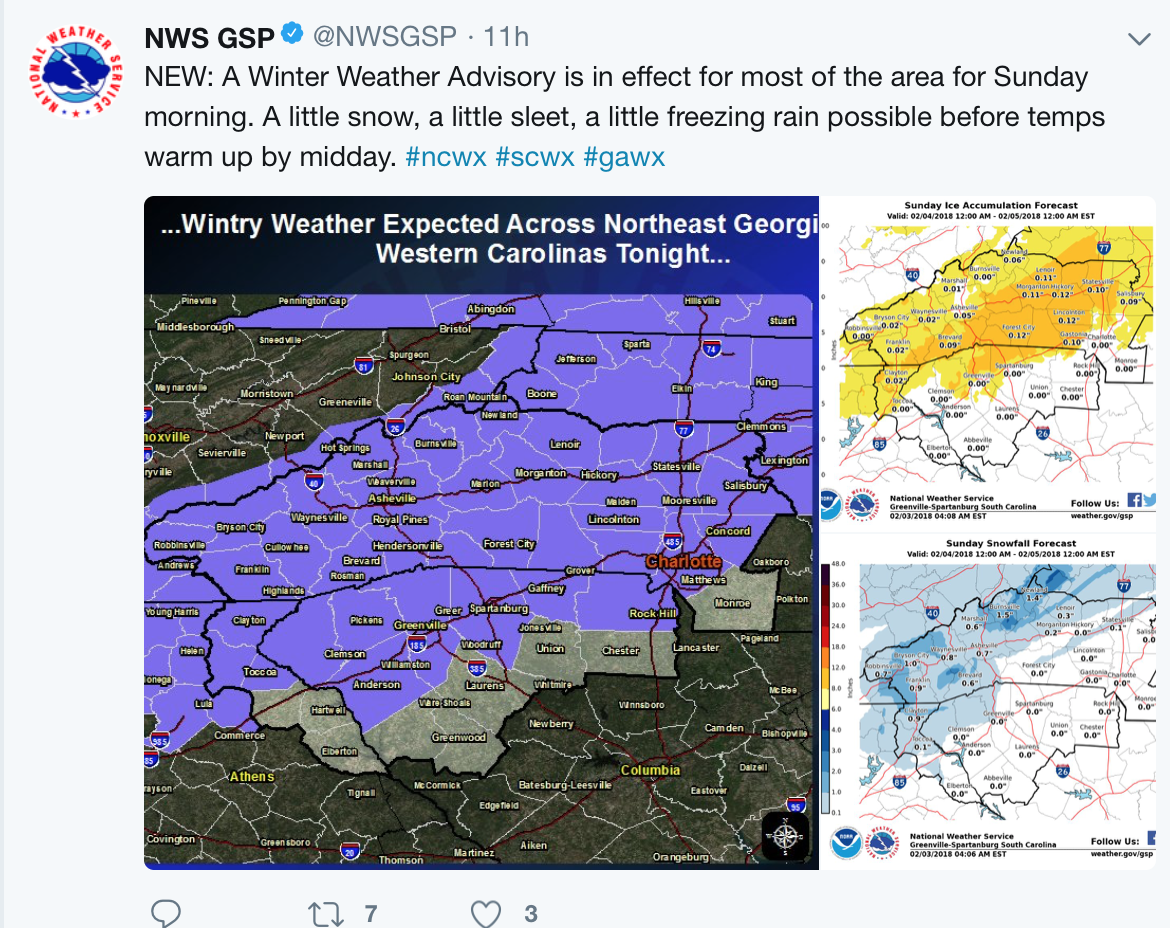
Try to stay off the roads after 1am tonight if you are within the advisory area. Also, try to stay off the roads before noon Sunday. Please stay safe!
-Mike G.
Meteorologist
East Coast Weather Authority
You must be logged in to post a comment.