
After a potentially powerful coastal low moves into New England this weekend, colder air wraps in behind this exiting storm system. There could be some impacts to watch with the coastal low before the cold air rushes in, such as flooding and strong gusty winds.
However when the system exits, strong winds behind will usher in much cooler/colder air. This could very well be our coldest air of the season.
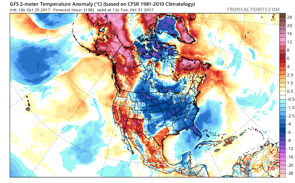
The GFS is indicating below normal temperatures for many including the Upper Midwest and into the Ohio River Valley and Southeast US. Even Florida may have to monitor for potential orange grove frosts or freezes.
This is the graphic for Halloween,
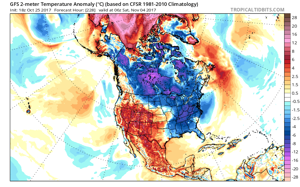
After a chilly Halloween, we then have another reinforcing shot of cooler air into Nov 4th. Therefore, we can say, into the first week of November we can expect below normal temperatures for many in the East. This could be promising for coastal storm lovers! When there is a trough in the East, in the upper air patterns, usually that is favorable for at least one coastal low. Snow or rain is not clear as of now.
Be sure to like us on Facebook if you haven’t already! Click the link >>> https://www.facebook.com/eastcoastwxauthority
Mike G.
You must be logged in to post a comment.