
As many of us know, the Mid-Atlantic and Northeast will bake just in time for the start of July. Temperatures in New England and NYC could exceed 100 F. Washington, DC and Philadelphia might not be able to escape the heat, with highs in the upper 90s possible in those locations.
After the 4th, the upper-level ridge or “heat dome” will take on interesting characteristics. It will actually begin to retrograde or move westward against the prevailing winds. The heat dome will then place itself over the upper Plains and Midwest.
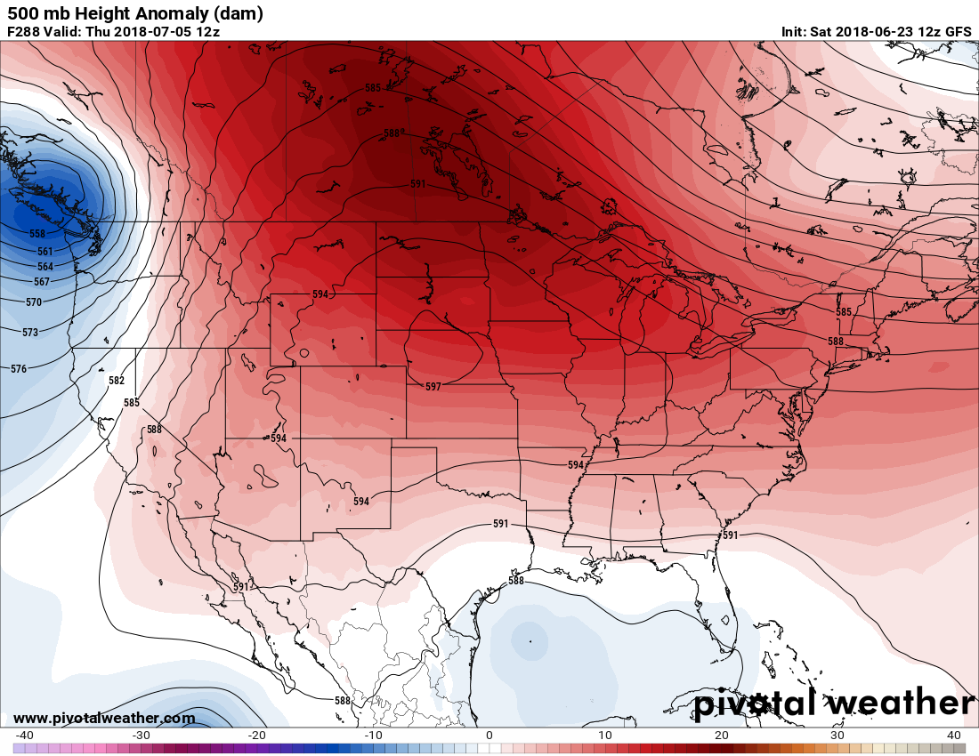
This could be problematic for agriculture across the nation’s midsection as dry conditions could take shape. Temperatures could reach some 19 degrees F above normal in western ND and also Montana. The heat will also extend northward into the Canadian prairies.

The main issue will be the dry conditions with this heat dome. This is due to sinking air which inhibits the formation of showers and thunderstorms.
Farmers in these areas should expect a decrease in natural precipitation, and may have to rely more on irrigation and sprinkler systems.
East Coast Weather Authority
For more information, sign up for our professional services in the link below:
You must be logged in to post a comment.