
OUTLOOK THROUGH MID-SEPTEMBER
It was though that cooler and less humid air may wrap in behind Dorian as he exits out to sea. This is not going to happen apparently, so we will still sweat quickly when we walk outside into next week. Those of us who have to wear suits for work, especially in the South, will feel uncomfortable as there are still no signs of fall. We thought there would be as Dorian made his exit.
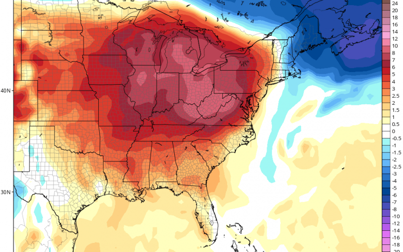
The latest Euro model forecast below for mid-week next week:
A ridge of high pressure will park itself over much of the eastern US and will continue to bring muggy and hot conditions to the Carolinas, This heat is not expected to break anytime soon, at least not through the middle of this month.
Air conditioning bills will likely still remain high for many of us in the Southeast, since the heat will persist. There is not one sign of fall just yet, so put that pumpkin spice latte thought on hold. We are still in iced coffee season.
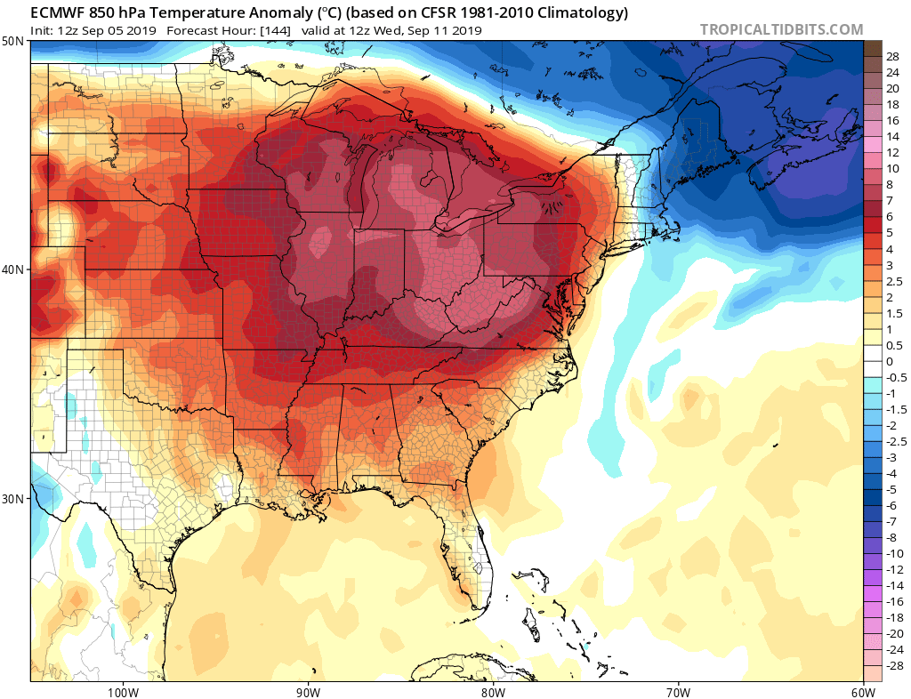
NWS Climate Prediction Center's 6-10 day, Sept. 11-15, Outlook for Temperature & Precipitation Probability. For Middle TN, a lean toward above normal temperatures & precipitation. pic.twitter.com/GuaF74MK9Z
— NWS Nashville (@NWSNashville) September 5, 2019
Precipitation is expected to be near normal, so it could be hot and dry. Of course any tropical systems will bring heavier amounts of rain.
Keep those shorts and short-sleeved shirts handy still! And DO NOT turn your backs on the tropics, as we are expected to have an active late season this year.
If you liked this article, please share with your family and friends using the below sharing buttons!
-CWA
You must be logged in to post a comment.