
After a bit of a break this weekend depending on your location, the heat will return for the East Coast this upcoming week. Temperatures on Sunday for the Northeast will feel very comfortable with lower humidity. However, across the South, showers and thunderstorms will persist as a result of instability from what will become Tropical Storm Chris.

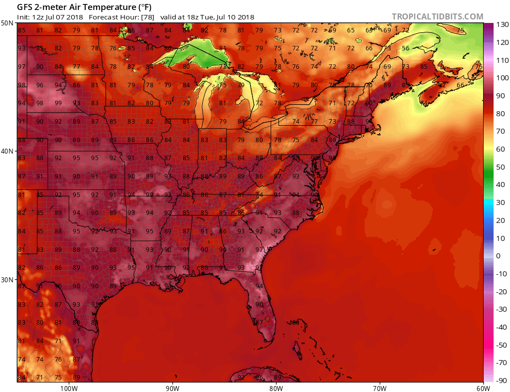
Widespread upper 80s to low 90s will be the theme this week and will be from the Carolinas to the Northeast. In eastern SC and GA, low to mid 90s can be expected but upper 90s cannot be ruled out at some point from Tuesday to Saturday.
Once again, stay hydrated and try to stay inside in the a/c especially during the hottest parts of the day. Limit outdoor strenuous work if possible.
We can see the heat return on the GFS starting Tuesday:
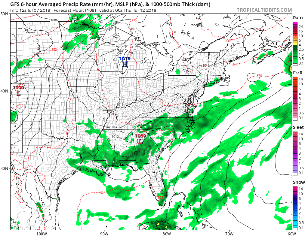
More showers and storms are possible across the South with the heat in the form of late-day thunderstorms. Wednesday looks to be an unsettled day for this upcoming week:
Care to sponsor us? Click here to Contact Us
East Coast Weather Authority
You must be logged in to post a comment.