
As if everyone wasn’t on edge enough so far this year, a tropical storm is now bearing down on the Caribbean and could affect the U.S. Mainland in the coming 7 days. There is still high uncertainty regarding the intensity and track of the storm. As of now, Isaias has Florida in his crosshairs, and even the west coast of Floria.
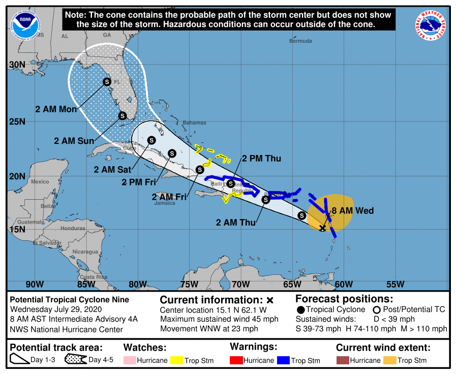
The latest official forecast from the NHC has Isaias on a more westward trend. It really depends on the exact track of Isaias, since if he stays over water most of the time he could rapidly intensify. This would not be good down the road from where he may hit. Below is the cone of uncertainty, as this storm can track anywhere within the cone, or even outside of it.
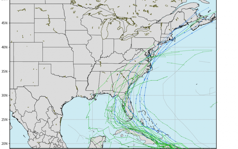
The latest Euro ensemble tracks have a wide spread still. We may not be able to get these models to tighten up until later this week or this weekend. Any one of these tracks is a possibility, so do not sleep on the more eastward tracks. The Floridan Panhandle should also not sleep on the more westward tracks.
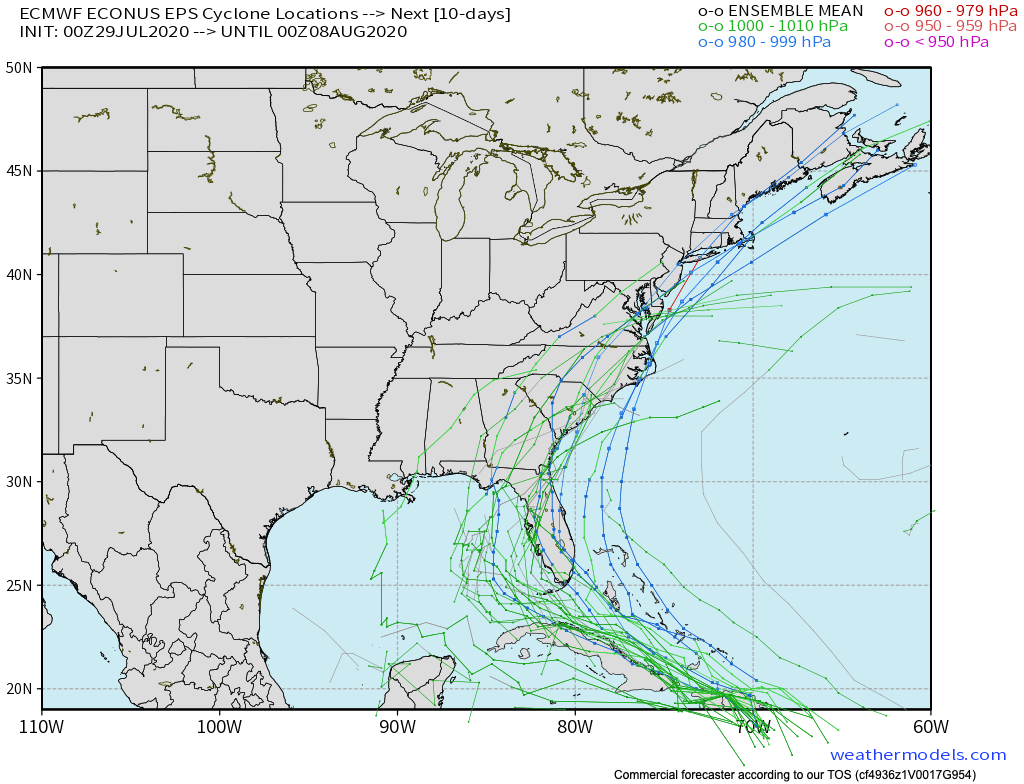
There is no doubt that this storm will be a pain to forecast. We have a feeling things can change last minute in this forecast, so expect any track to be possible and any level of intensity of a storm.
Even the official forecasts can shift over time. We think that it may hug the Southeast coast and come up into the Carolinas, or even a recurve that brushes the Outer Banks like Dorian did.
The one thing that is certain about Isaias, is uncertainty. Lack of model data this year will throw a wrench into guidance accuracy and the overall forecast this hurricane season.
-CWA
You must be logged in to post a comment.