
As the days have recently been on the cooler side, and with clouds, it has not really felt like summer. In fact, we could be in relief up until this weekend, or perhaps late this weekend. Now is the time to get those a/c units serviced if they are not blowing cold.
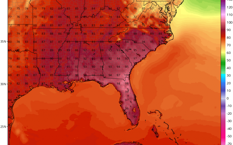
The GFS is showing that we hit 90 for the first time on Monday, but it could be before then. In fact, it could be this weekend. If you live in Charleston or anywhere along the SC/GA/FL coast, prepare to roast!
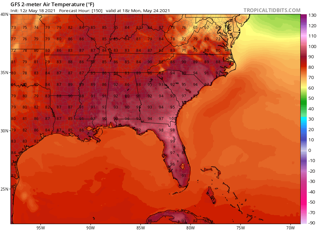
And we could hit 90 for 3 days in a row around this time next week, which would classify as a heatwave. So once we hit 90 it will be that or above for the foreseeable future. Unfortunately, this also means dry since there won’t be much in the way of afternoon storms.
The 5-day total rain forecast has us fairly dry as we will be right under the ridge of high pressure.

An ensuing drought and high fire danger is not out of the question over the next two weeks. Keeping lawns green will take a lot of work, and it might become impossible at some point. Local water usage and guidelines may be implemented.
For now, expect seasonable conditions later this week but with a lack of rain. We also don’t have long until the start of hurricane season which is June 1st.
You must be logged in to post a comment.