
As we are only going to get warmer over the next 5 days, some of us may be wondering which day or time range will be the hottest. As of now, current model guidance suggests that Monday will be the hottest, with highs in mid 90s. Tuesday could even edge Monday with slightly higher temperatures.
Given that it will be very dry, these numbers may be on the low side. Some locations in the Carolinas could hit 100, although that is on the upper end of the range of highs. We don’t think it will be that crazy hot. But upper 90s are not out of the question.
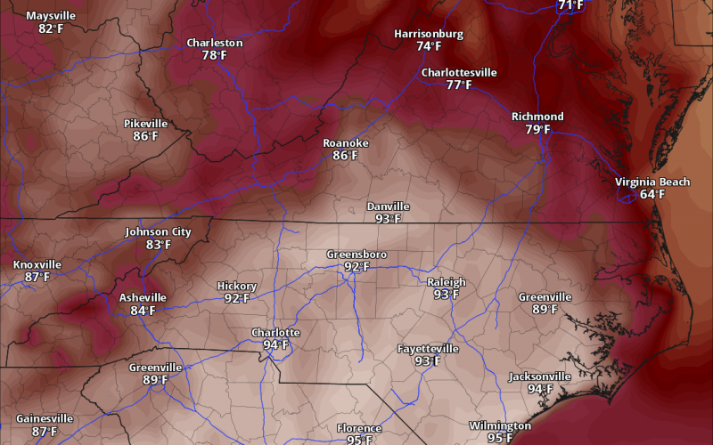
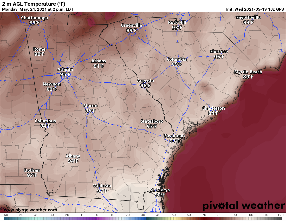
Below are model forecast highs for Monday.
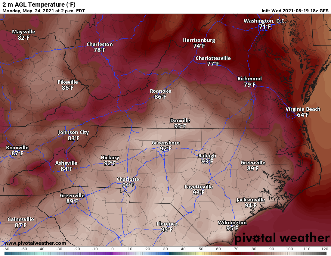
Charlotte, Wilmington, and Florence will be quite toasty. As we take a look a big farther South, most of SC and GA will also be involved with the heatwave. Savannah is looking toasty at 97 and so is Columbia at 95.
We are not expecting overall high humidity, which will add to the dryness. When the air is very dry with low dewpoints, that allows the air temperature to skyrocket quickly. Again, some of these high temperatures may be on the “low” side.
There are some credible forecasters that think Tuesday will instead be the hottest day, and that is certainly possible so we will not argue. It also depends on exact location. Honestly, it might not feel much different between Monday and Tuesday next week.
One week from today the guidance is really starting to crank up the heat. Some indications of near 100° in a few places. A week more of no rain with dry air and dry soils these higher afternoon highs are possible under this ridge. #cltwx #ncwx #scwx #wcnc #HeatWave pic.twitter.com/Uuu5jWyHVo
— Brad Panovich (@wxbrad) May 19, 2021
Make sure your air conditioning is in top notch in your car or truck and especially your home. This heat will be dangerous.Limit time spent outside in the sun as your body might not be used to it and it can make you sick.
Spread the word and please share!
You must be logged in to post a comment.