
As forecasted, the coming heatwave will be in full force this week. On Monday and Tuesday, highs will soar into the mid 90s for many. By the end of the week and even this coming Saturday, we could see highs in the upper 90s in certain spots. Pool season is well underway, and there’s no going back at this point. There could be some cold fronts in June, however they start to slow down this time of year, especially in the South.
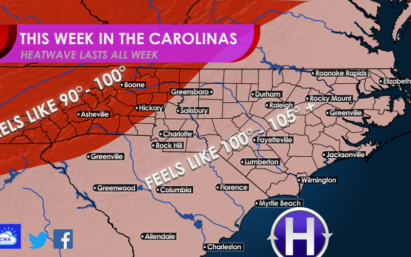
Temperatures will feel like 100-105 and even higher at any given time this week, and this looks to persist all this weekend and into next weekend.
Each day this week will likely be above 90° for many, and depending on the day of the week some could even see mid to upper 90s. Below is the GFS high temperatures for Wednesday. It appears the only locations for relief will the the mountains and foothills. Or the beach if there is a seabreeze, but even there it will be hot.

The Euro is more aggressive with the heat this week, and has many locations pasted with mid to upper 90s for about two days. These temperatures will be more likely in eastern parts of VA, NC and SC.
Drink plenty of water if you plan to be outside for an extended time. Try to limit outdoor activities to the mornings and evenings. That way the sun won’t “cook you alive.”
The heat looks to continue into Saturday, which we are watching for more potential record highs. It’s a bit too late but make sure your a/c systems are in top order and your pool is clean!
Take it easy this week and welcome the early arrival of summer.
You must be logged in to post a comment.