
A surprise snow will sneak up on some Wednesday morning, including those in the Hampton Roads, VA area and eastern NC. If there is any accumulation with this system, it will be light. And if there is an icy mix only it will likely be limited to NC.
The next concern is Thursday into Thursday night. An ice storm is possible across GA, SC, and southeast NC including Fayetteville and Wilmington. Be prepared for icy roads that are impassable, and also power outages that could last for a couple of days.
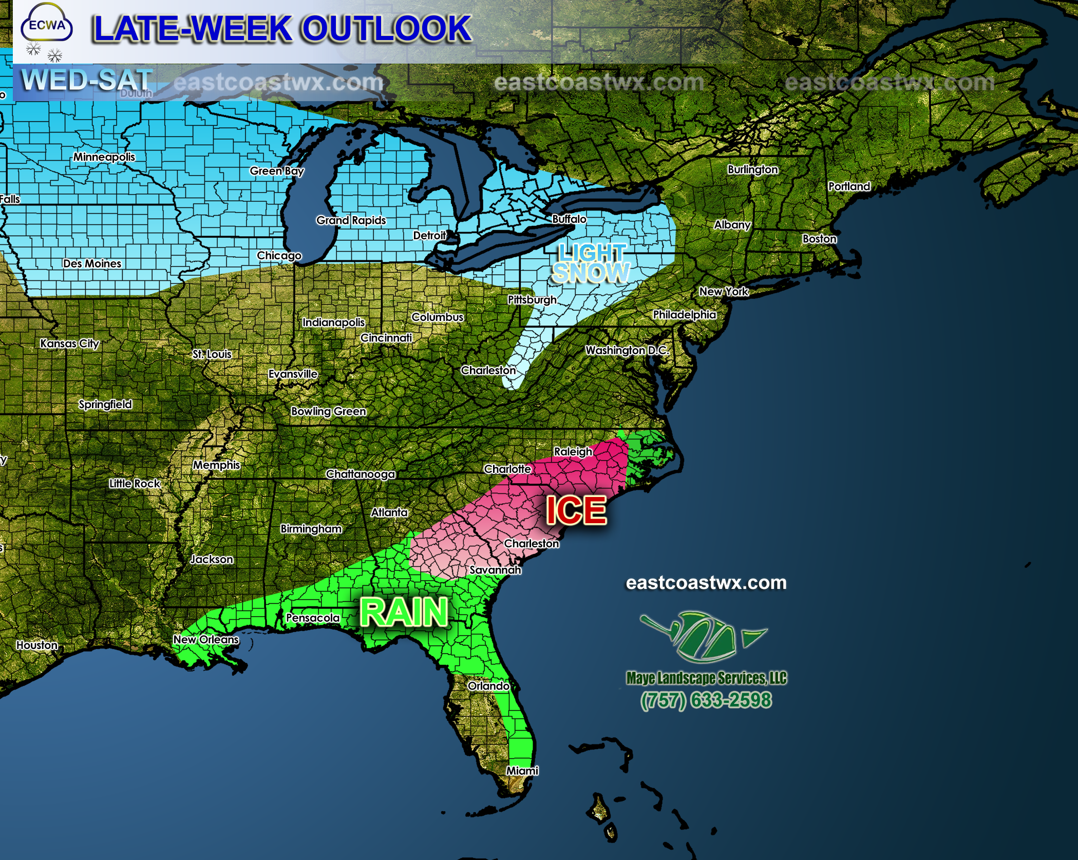
A Clipper system will move through well to the north, and will bring dustings to an inch across much of the Northeast and Upper Midwest. This is the northern stream energy that was “supposed” to bring our late-week 29-30th storm. It is obvious these pieces of energy will not phase together now.
Yes, there is a concern for New Year’s Even and New Year’s Day. More on that later.
Since more storms are on the horizon, so make sure you like us on Facebook! Link to our page >>> https://www.facebook.com/eastcoastwxauthority
-Mike G.
You must be logged in to post a comment.