
There will be a nice change of air on the way for this weekend, however the Southeast may not feel too much of a change other than lower humidity. Air temperatures will not lower drastically. Although, the recent swampy heat indices will not be around this weekend. This could be our first glimpse into a late-August airmass.
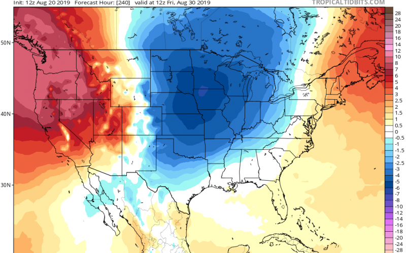
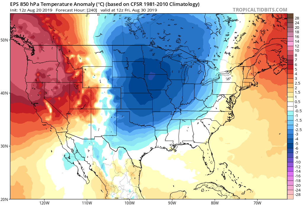
Speaking of which, a more robust pattern change is on the way right around month’s end. A much cooler air mass will move out of the Canadian Rockies and into the Plains. This cooler air will then spill into the East, making for fall-like temperatures around the 30th or 31st. The Euro model is shown below. We will have to watch and see if this trend holds.
The question is: will there be a Bermuda High that will prevent the cooler air from reaching us? This shot of cooler air may be strong enough to muscle into the high pressure and cool us down. But if the ridge of high pressure is strong enough, we may not see much temperature difference.
Stay tuned!
You must be logged in to post a comment.