
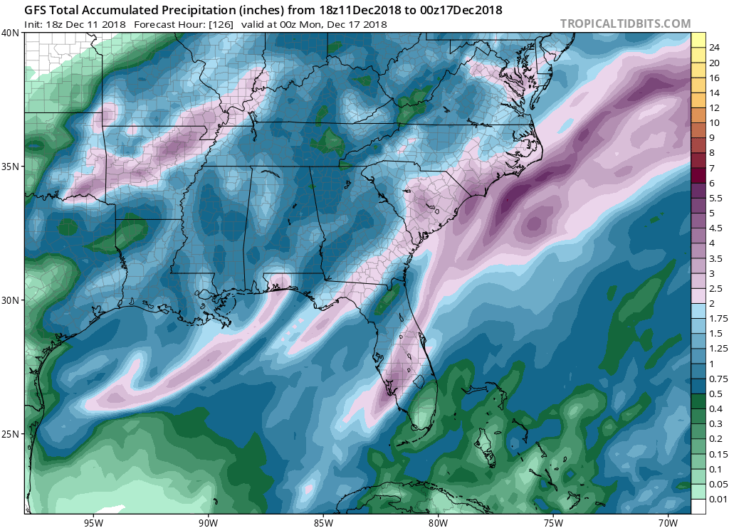
This last weekend the Mid-Atlantic and Southeast experienced a brutal storm that caused havoc across the region bringing with it strong winds, heavy rain, and heavy snow. Well guess what, to end this week another strong system will swing across the southern half of the country bringing even more rain to the region.
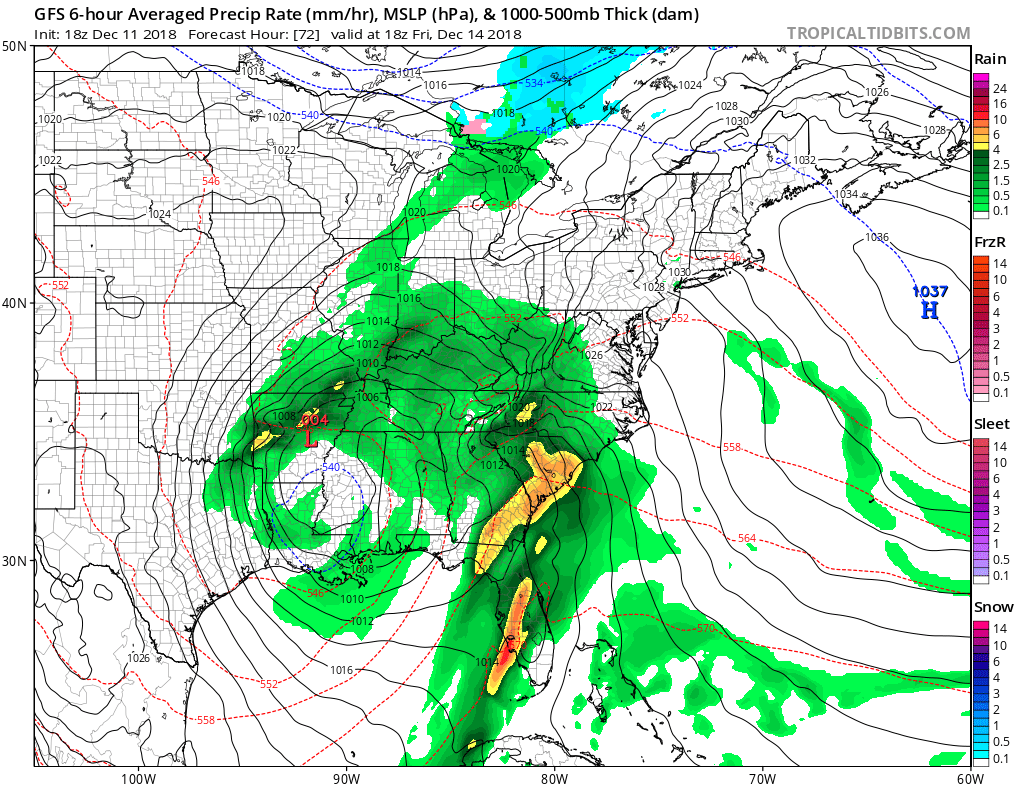
Overnight Thursday and into Friday morning a low pressure system will make its way to the Southeast where heavy rainfall will begin. Rain will likely persist overnight into Saturday where the low will eventually make its way through the region and move out to sea.
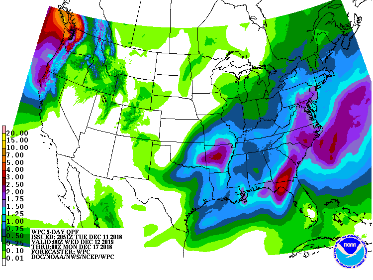
Due to the fact that the storm is relatively moving slowly through the region and there will be very large amounts of precipitable water in Georgia and along the coast of the Carolinas, multiple inches of rain across these areas will be expected. Considering the current snow pack in the Carolinas and Virginia, and the amount of precipitation expected to fall, flooding should be expected across the southeast. Winds could be strong at times from 10-15mph and gusts of 25mph raising the risk of downed trees. Stay safe and check back with us here at East Coast Weather Authority to get your latest update on weathers worst.
-Benjamin Charles
You must be logged in to post a comment.