
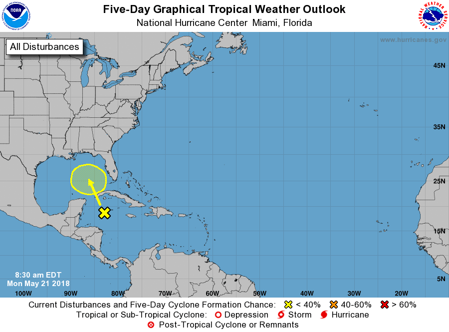
The unofficial start to summer is this weekend, and vacation destinations along the Southeast coast will not be the hottest destinations this year. We are watching for a potential tropical cyclone for areas from the Carolinas down to Texas. These areas must be on alert for heavy rain and the possibility of tropical storm force winds.
There is currently an area of showers and storms to the south of Cuba that are getting there act together as they move northwest.
GOES 16 Visible Satellite as of 1650Z:
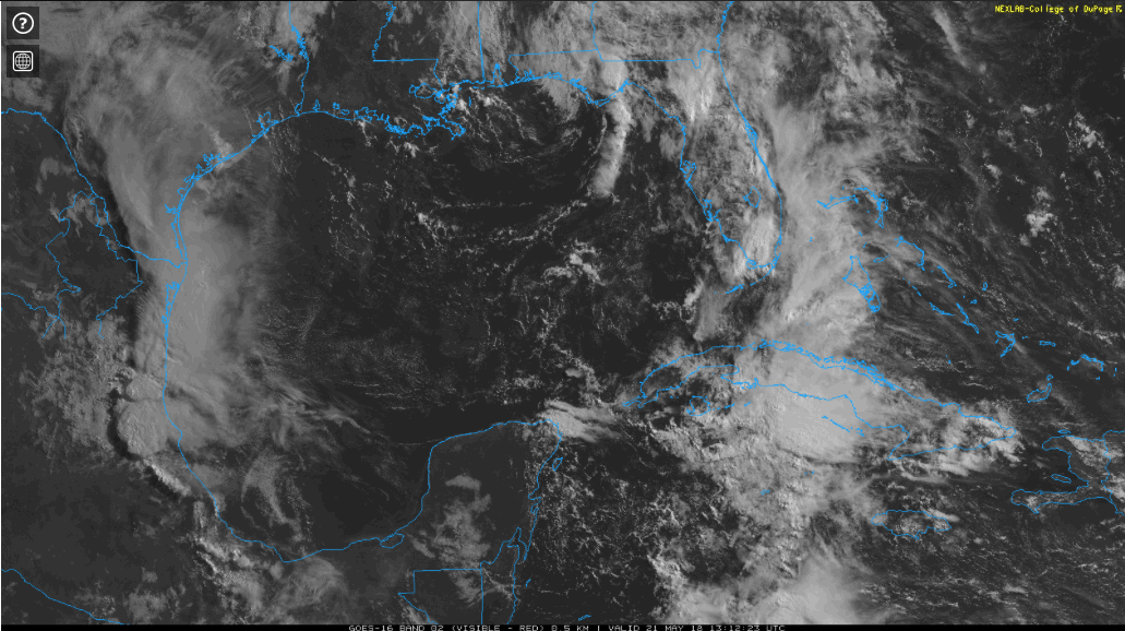
Those showers and storms are what we and the National Hurricane Center are watching for possible tropical development.
NHC 5-Day Graphical Outlook:
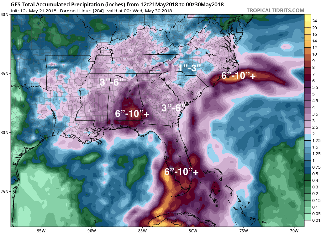
The biggest impact with this upcoming tropical disturbance is heavy rain. Both global models have the center of the system stalling out and dumping another 6+ inches of rain over areas that are already drenched.
GFS Total Precipitation Through WED May 30th, 2018:
Make sure you stay with us here at East Coast Weather Authority as we get you ready and keep you up to date for what mother nature has to bring.
-Alex B
You must be logged in to post a comment.