
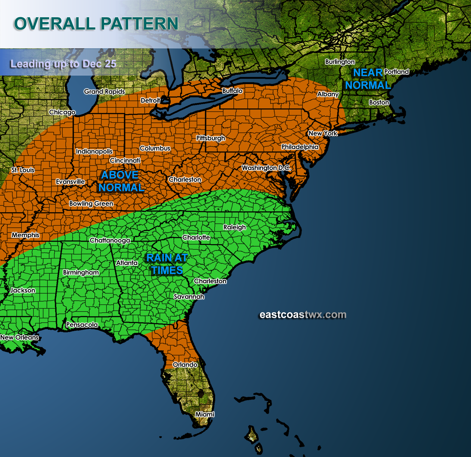
From the 15th to Christmas Day (Dec 25th), above normal temperatures will take over the eastern half of the US. Things will be tranquil into the weekend, and then late Sunday into Monday the threat for showers and rain return to the South. Leading up until the 22nd or so we have to start watching for changes. An ice storm is still very possible for Christmas. See our other blog post for the story.
If it stays mild up until Christmas, that is on the border of seasonable, and please keep in mind winter has not even started yet. It could come in with a bang, and that bang could be transformers blowing across the Plains and Tennessee Valley.
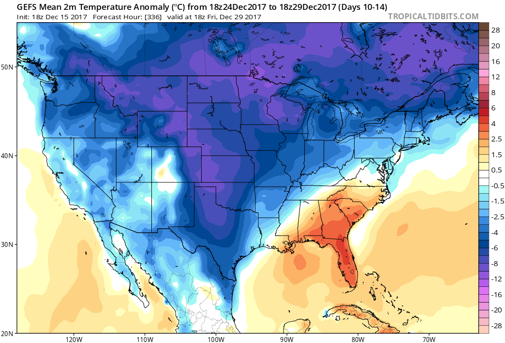
After this wave of low pressure makes it’s exit, cold air will follow. Below normal temperatures are expected on the GEFS ensembles all the way until the end of December. The 24th to the 29th is shown.
If you live in any ice storm prone areas, it may not be a bad idea to start stocking up on some firewood to keep warm, since ice storms can have very low temperatures, well below freezing.
Enjoy the mild weather for now, and be prepared for it to change quickly!
For more details and our own custom suite for members only, sign up today >>> https://carolinawxauthority.com/membership-options
-Mike G.
You must be logged in to post a comment.