
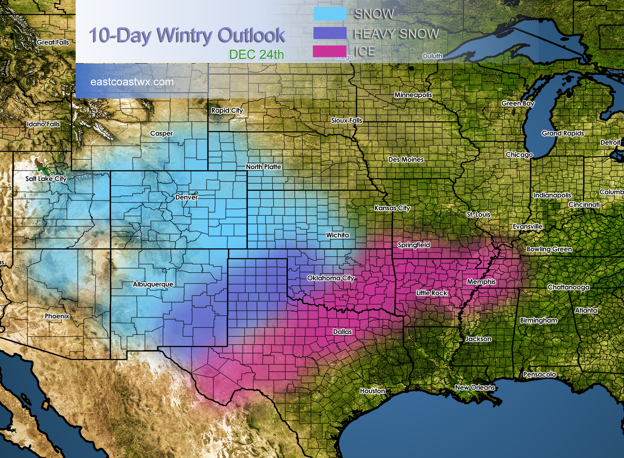
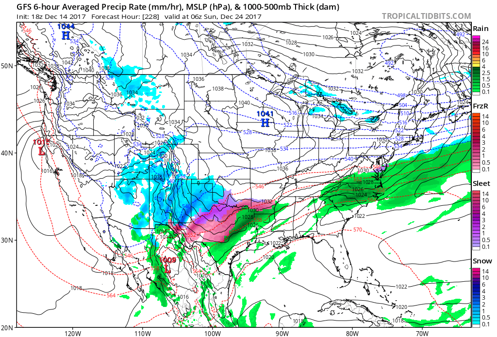
While much of the East becomes warm, as a ridge of high pressure will build in, the Midwest will remain cold with disturbances moving in from the Rockies and the southern branch of the jet stream. The pattern is signaling overrunning, where warmer air overruns cold air underneath close to the surface. This would mean freezing rain, and that certainly could be possible across Texas.
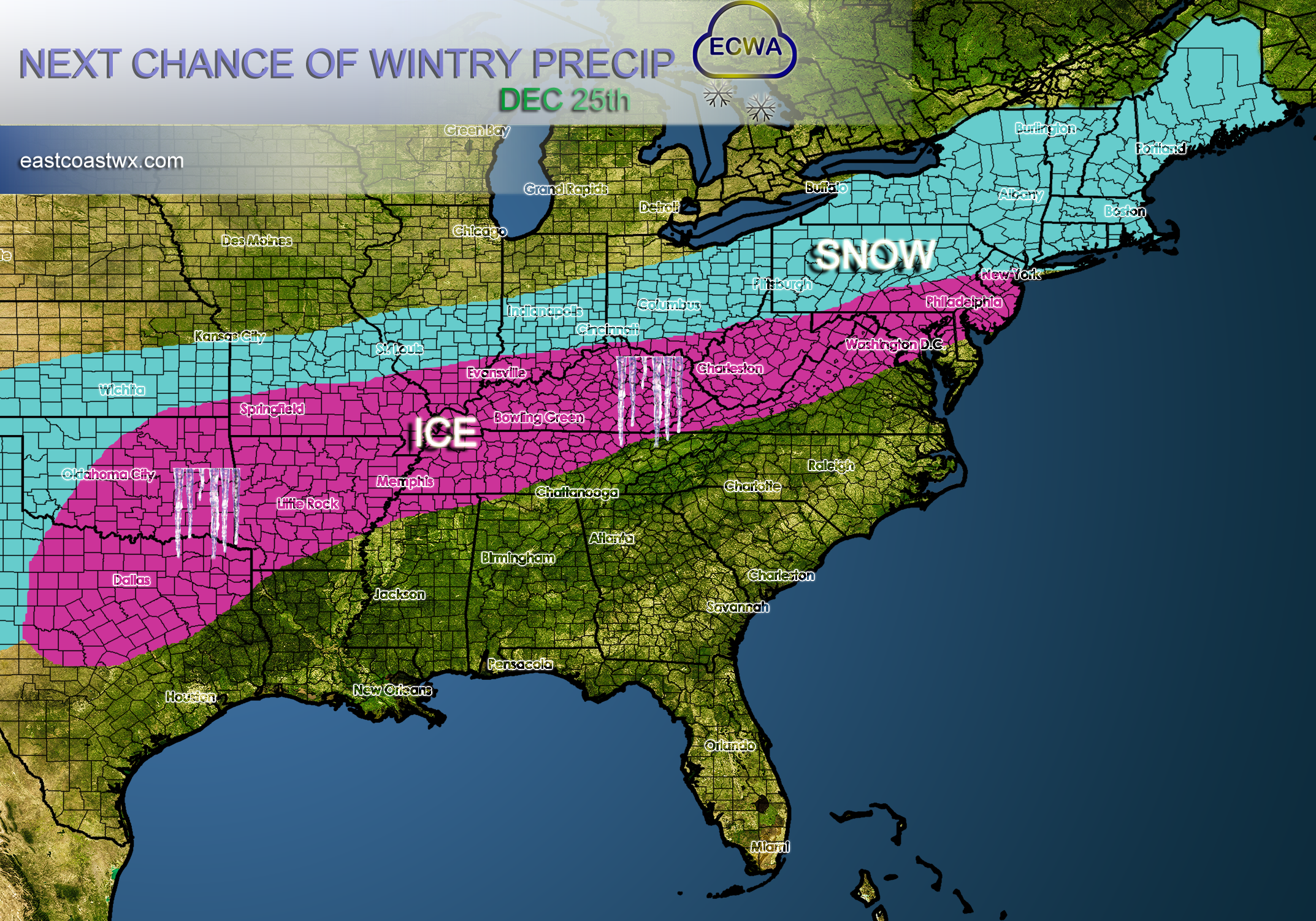
Heads up for a potential ice storm that might make the news for Christmas. It is hard to tell the magnitude at this point, since these events are very “fragile” and depend heavily on where the cold air is situated. If you live in or near the pink, please think about power outages and sub-freezing temperatures for Christmas, and also for travel plans.
The GFS has been locking into a Texas winter storm. Dallas would be on the edge of this mess. The Panhandle could see some decent snows.
Thanks for reading this 10 Day Wintry Outlook!
For more details and our own custom suite for members only, sign up today >>> https://carolinawxauthority.com/membership-options
-Mike G.
You must be logged in to post a comment.