
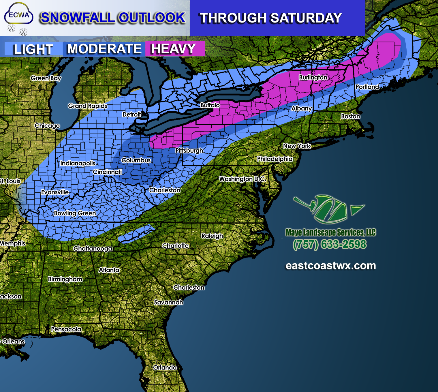
A winter storm will trek across the nation’s heartland on Thursday and Friday this week. Ahead of the storm system, all rain is expected in the east. On the backside of the storm is where we begin to see winter issues, extending into Indianapolis.
This system will push into the Northeast into the weekend. Conditions will deteriorate late Friday into Saturday morning. Saturday is when any rain will changeover to sleet and then momentarily snow.
However, this system is not expected to be all snow. Most of the liquid potential fill fall in the form of sleet and freezing rain. The biggest threat for ice is from the lower Ohio River valley and into the interior Northeast all the way up to Maine. This could be a major issue, especially with power outages and dangerous driving and walking conditions.
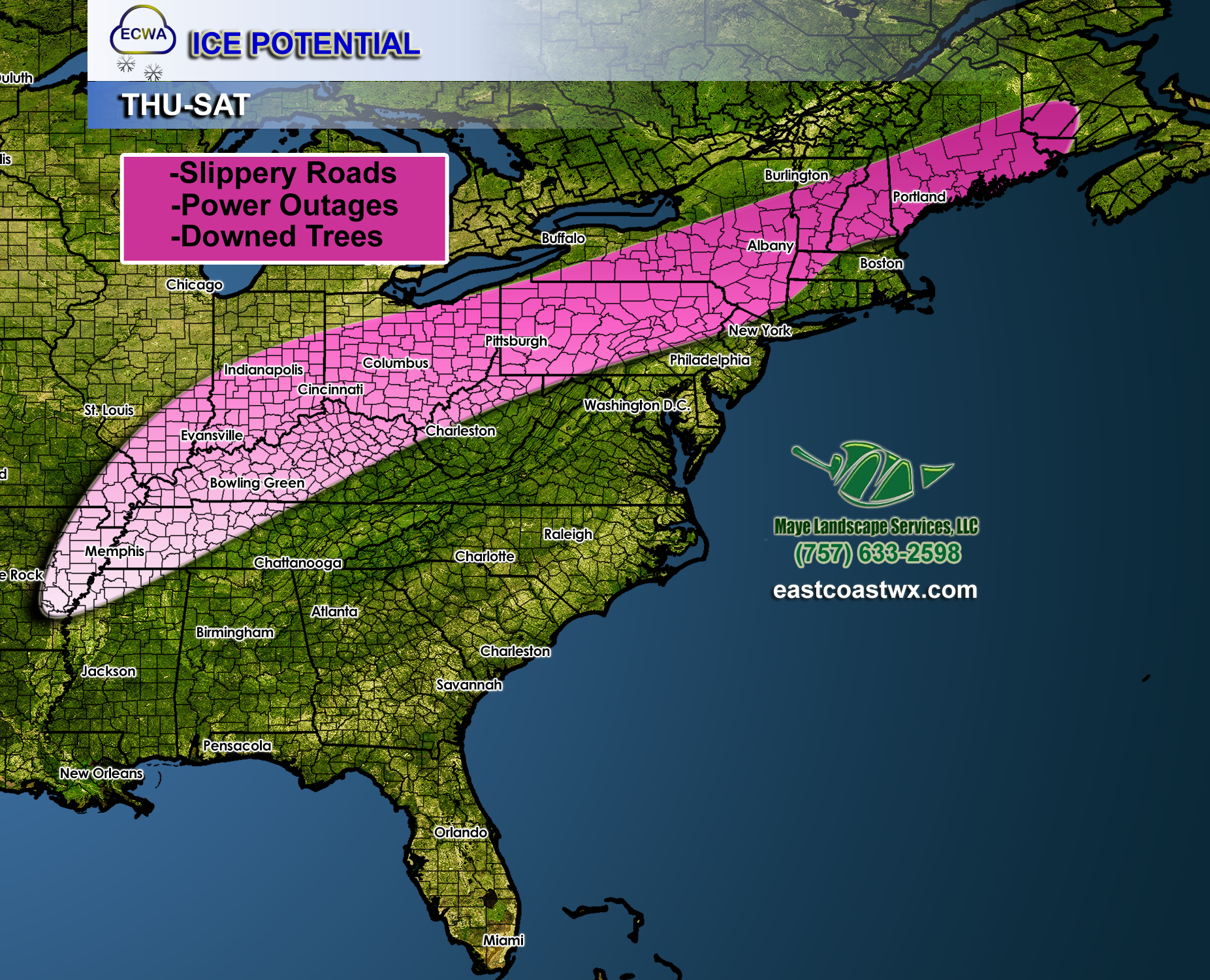
Some of this ice may make it’s way into eastern PA, into locations such as Allentown and the Lehigh Valley. There could be some severe icing issues into the far northern and western suburbs of Philadelphia. Things could get messy from Northeast PA into Lancaster and Berks County.
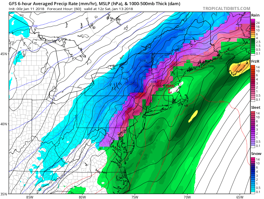
Northeast wake-up weather on Saturday is shown. It seems as though things will be too warm for snow closer to the coast, although anyone in those locations could see a brief changeover right before the storm exits.
The wintry mess should be gone by Saturday 7pm.
If you have a business that depends on the weather, consider subscribing for our professional services. Pricing is negotiable >>> https://eastcoatwx.com/subscription-options
-Mike G
You must be logged in to post a comment.