
There is no rest for the weary if you do not like the cold. There is a short reprieve this week from the cold, as it will be warmer than average, but then the thermometers tumble once again into the weekend. This cold should last into early next week, but then another slow warmup will occur once again. This warmup is expected to last after the next cold wave ends, and will last into the 20th-25th. Then, either on or after the 25th, the severe cold makes it’s presence known once again.
When the stratosphere warms, as shown in the GEFS forecast for 1/17/18 below, the Polar Vortex is essentially “squeezed” and part of it is forced over North America and even Europe. However, this is about 30 miles up in the atmosphere, and it takes about 8-12 days for the cold to reach the surface and spill into the upper parts of the US.

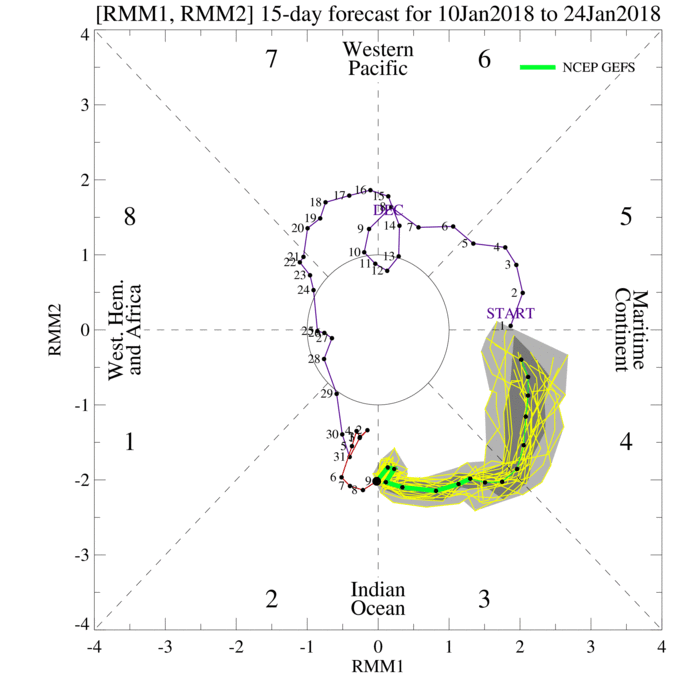
Since this is forecast to occur around the 17th, we can say that around the 25th we can start expecting another visit of more Arctic bone-chilling air. We can examine the MJO forecast, which also tells a good story of what to expect in the long-range. The green lines are the forecast in the MJO phase diagram below. We are entering phase 3, 4, and 5 which means we will be warming up overall, so any cold outbreaks in the near future will likely be short-lived.
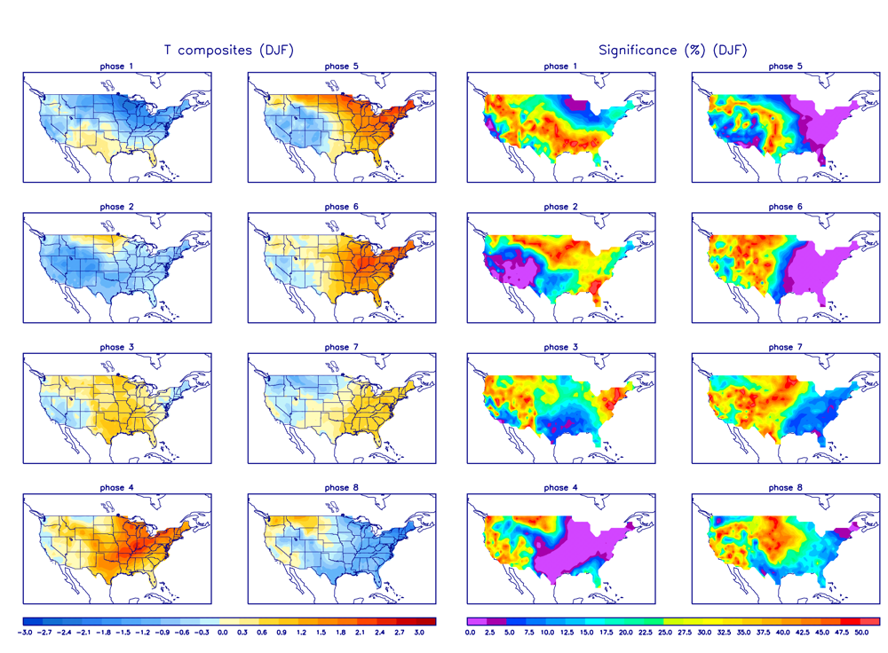
Phases 3,4, and 5 on the below diagram indicate a warmer eastern half of the US. This will be through at least the 24th. There will be some cold waves that move in behind departing storm systems, but severe long-lived cold is not likely until after the 24th. I suspect we will even see phase 6 before another major shift is coming due to stratospheric warming.
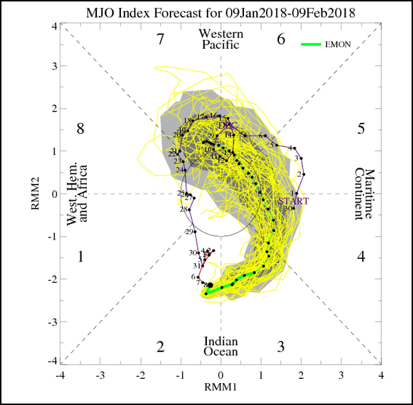
The MJO is forecast to start heading into Phase 7 once again, and then Phase 8 heading into February. There is a considerable spread between the model scenarios, as expected this far out. However, if we cycle thorough phases 8, 1, and 2 shown above, we will go back into the deep freezer after the 24th and into February.
It appears the stratosphere will continue to warm into the 26th, which would continue to extend a lobe of the Polar Vortex into North America. This means very harsh and bitter cold, with an enhanced chance of coastal snowstorms. Pretty incredible what happens here in the States into February.

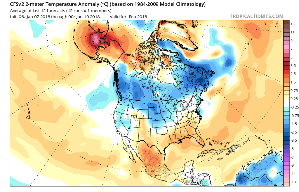
Does this agree with the GEFS temperature departures? The GEFS has been all over the place not really able to catch onto the end-of-month cold very well. So we will look at the CFS v2, although these long-range climate models seems to have a warm bias. But if the CFS is sniffing out cold, then we can bet that it will be cold for that time frame. The CFS monthlies indicate the cold will return to lower Canada and the US for February.
End note: there will be cold waves that follow warm spells, but the real cold makes a visit once again after the 25th and to start February, as snow and ice chances go up once again. Until then, really tough to get any snow along the East Coast, but that will change.
Model images courtesy of http://www.tropicaltidbits.com
Mike Griffith
Meteorologist
We are hiring college interns that are in a Meteorology curriculum, and also meteorologists looking to work part-time. Email: [email protected] your resume or CV.
Become a member! Sign up here today for more in-depth outlooks and timely early information >>> https://carolinawxauthority.com/subscription-options
You must be logged in to post a comment.