
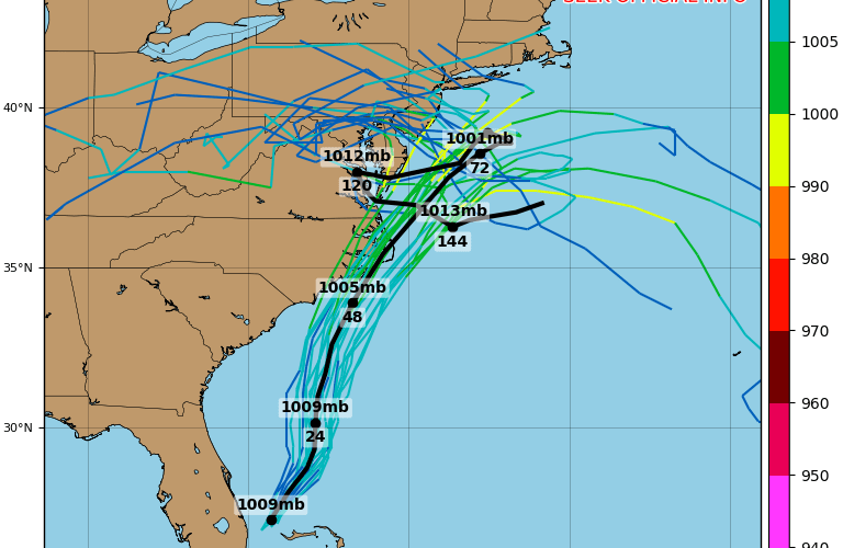
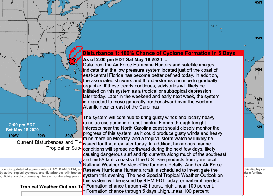
It didn’t take long for the models to start disagreeing on what could be Arthur heading out to sea. In fact, models changed overnight. This is not unusual with tropical systems, and the lack of aircraft data with covid-19 has also thrown a wrench into the forecast with lack of model data. The latest information from the NHC with a near 100% chance of formation:
The GEFS ensemble tracks are now in disagreement whether a tropical storm either goes out to sea or curves to the west, going right over eastern NC and into the Delmarva. That being said, it not longer purely looks like this is going to be fish storm, although the possibility is still on the table.
Below are the last possible tracks of what could be future Arthur.
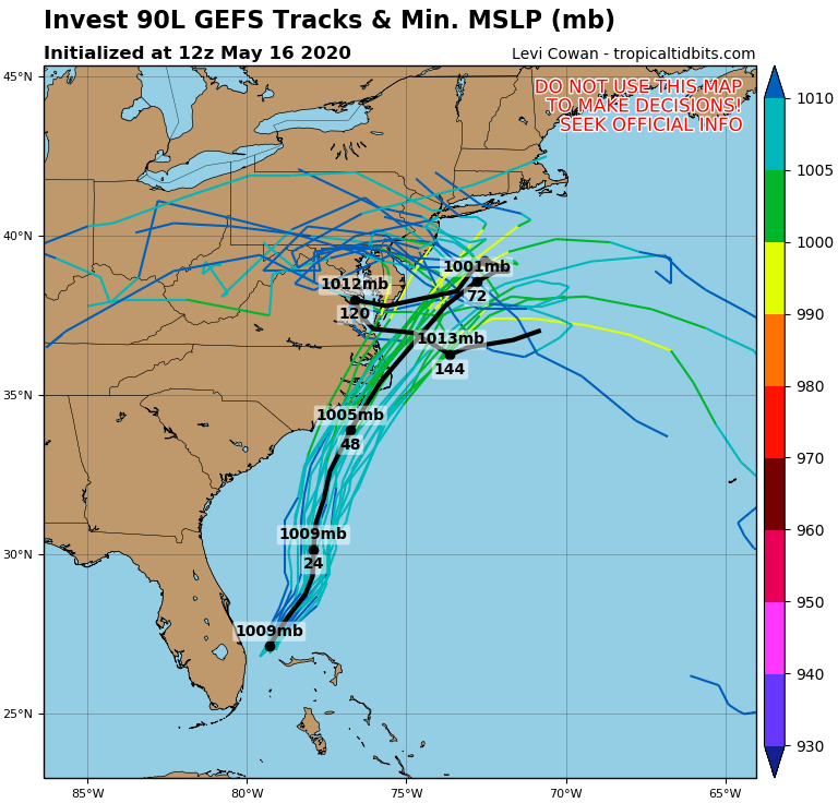
The GFS operational model has the system tracking between the mainland of NC and the Outer Banks. This may not be an exact track, since the model trends are still westward. It will could be more west, so folks from Wilmington, NC to Norfolk, VA should be on the lookout.

This system is not expected to be a hurricane at this time. Rather, a weak or moderate tropical storm is expected at best. It is still not a great idea to go outside anyway right now other than for essentials, and if everyone stays home when there’s a tropical storm, everything will be fine.
Keep it right here to Carolina Weather Authority for all the latest updates.
You must be logged in to post a comment.