
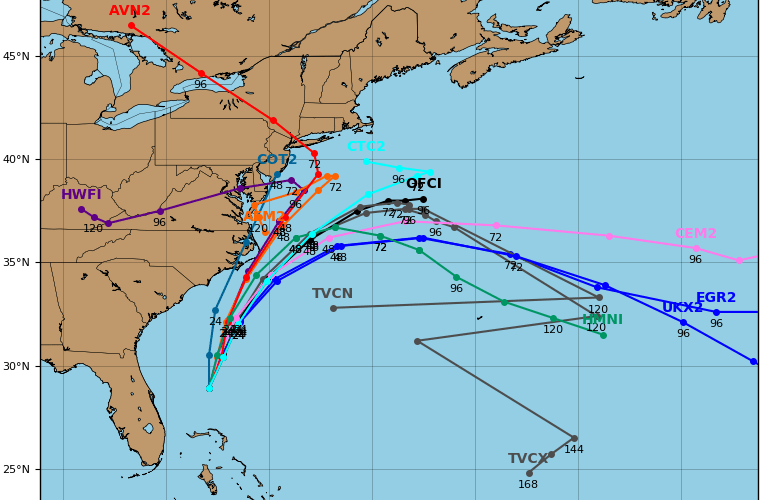
Right now there is an instability in the models. Some have what could be future Arthur moving over land, others have him going out to sea. Right now, there is a spread in the models, as they are seemingly confused. What does this mean, and why?
Currently, global hurricane models are split between a more westward track and out to sea. This is due to an upper-level feature approaching from the west. It could have an influence on future Arthur’s track which would either bring him inland or out to sea.
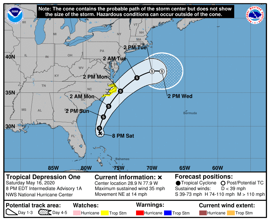
Currently the mean or average cone of uncertainty from the NHC is a slow right hook and out to sea based on their latest advisory. He is then expected to stall somewhere out to sea. However, Tropical Storm Watches are posted along the NC coastline including the Outer Banks. Conditions could reach tropical storm-force within the next 60-72 hours.
What do we think? As of now, we are waiting for the model guidance to stabilize and come to more of a consensus. However, the euro model which handles these system extraordinarily well, shows the storm heading out to sea. This could be where the NHC is getting there forecast from.

However, we will have a better picture on Sunday (tomorrow) as to a more certain forecast track for Arthur! Please keep it tuned right here, as we will update you when the latest Euro model comes out. It has a pretty decent track record!
-CWA
You must be logged in to post a comment.