
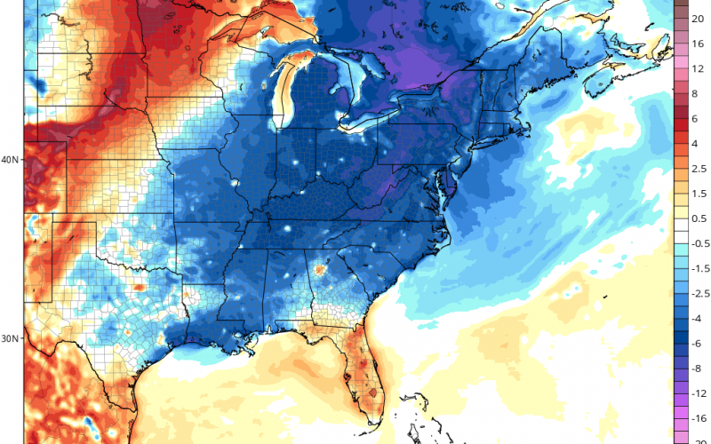
It seems as though our weather debts will be paid in full starting this weekend and especially next week, as a major storm system gets its act together in the eastern half of the US. Temperatures by next Tuesday morning will be in the 50s for many east of the Mississippi and 40s by Wednesday morning. This will likely be due to a large storm system bringing MUCH NEEDED rain to our region.
Next Wednesday morning temperature anomalies according to the GFS:
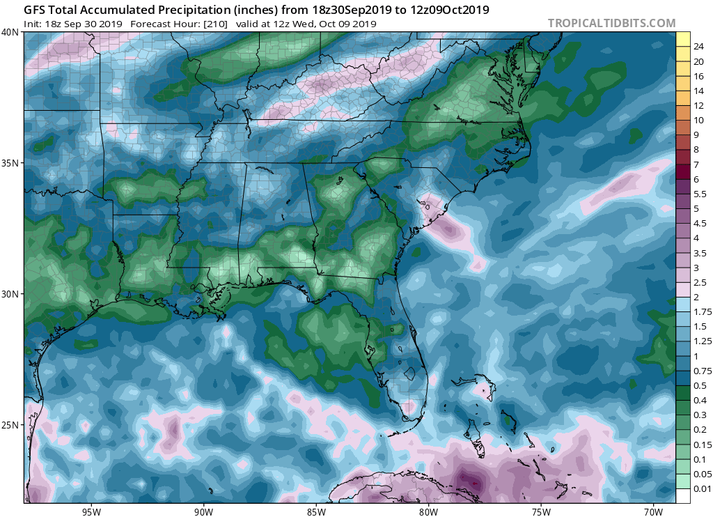
Images taken from tropicaltidbits.com

The double delight here will be the much lower temperatures and the rain to quench the ongoing drought. Summer will be here this week with temperatures still in the mid 90s and even upper 90s in spots, so if you like summer, get outside since this will likely be the last time we experience it this year.
Our chances for rain go up much higher next week as the storm system spins up and pushed rain east, which is a much welcomed sight. While we are still severely below normal precipitation-wise with brown lawns, we will take any rain we can get. This may or may not be a drought buster depending on how much moisture is associated with this storm. Florida will likely benefit the most.
If you can get through the heat this week, rewards are at the end of the tunnel this weekend and next week!
-CWA
You must be logged in to post a comment.