
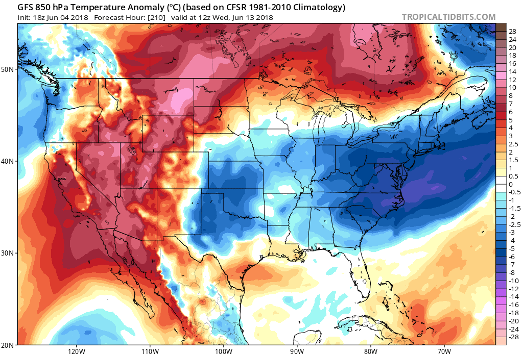
Who enjoyed the cooler temperatures and lower humidity across the Southeast today? If you did, you won’t have to wait long for another shot of relief. The humidity will creep back in and it will get warm again to finish out this week, but then around the same time next week another cold front pushes through the region on Wednesday the 13th. This could be one last shot at “spring” trying to hold on before summer officially arrives. Daytime high temperatures according to the GFS might struggle to hit 80 F with sunshine! Meanwhile, the Southeast and Texas will continue to bake with record high temperatures. If this persists, it’s looking like a very rough summer for those locations.

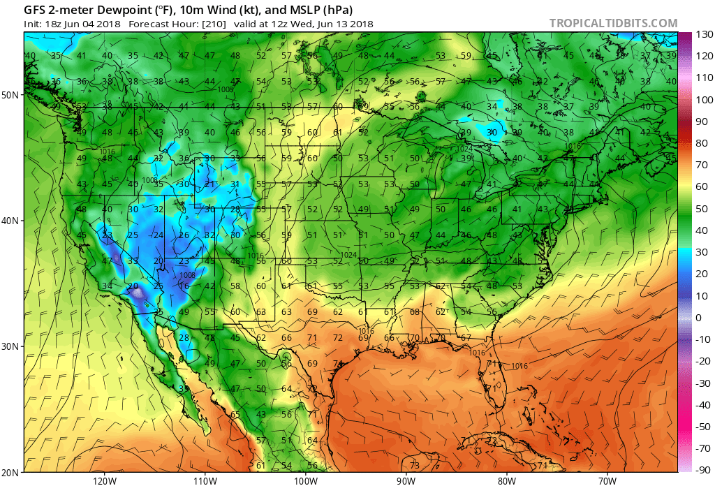
As an added bonus, Wednesday June 13th dewpoints will be in the 50s in many locations across the Carolinas, making it feel cooler than usual. This is a big shift from the month of May.
Enjoy the continued cooler air for Tuesday and for some folks farther north into Wednesday. Then we can anticipate our next arrival of cool air!
Become a patron of ECWA and support us with a donation! You will receive a reward or service from us in return: https://www.patreon.com/eastcoastweatherauthority
We thank you!
You must be logged in to post a comment.