
It is a broken record across the southeast by now, but more rain is on the way. The unsettled pattern is due to an atmospheric river of moisture that has continuously brought the threat of showers and storms to the region. The unsettled pattern will not release its grip on the region over the next week.
Over the past 2 weeks many places have seen way above normal precipitation, and as we continue through the next week we will only be adding to that total.
NOAA Precipitation Analysis Over the Past 14 Days:
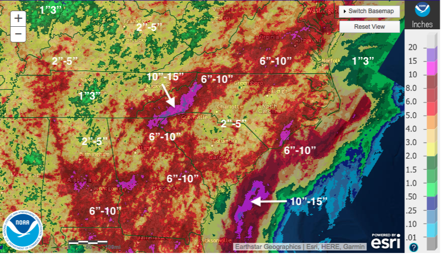
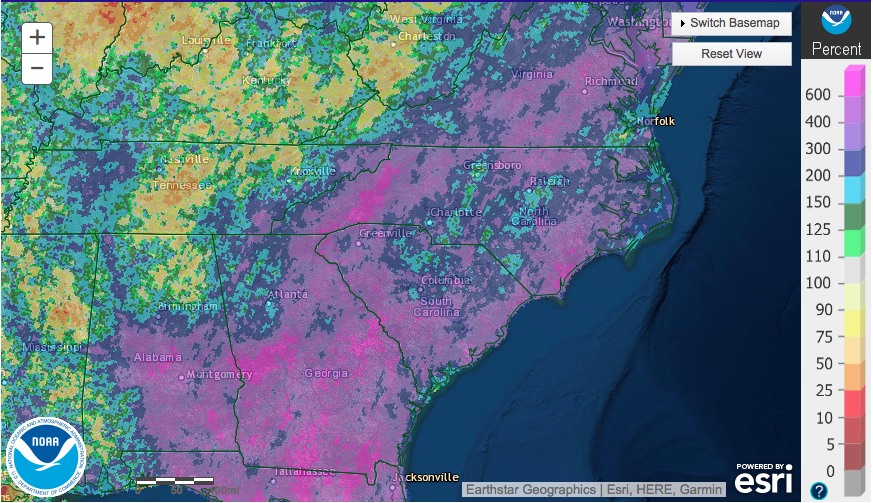
The amount of rain that has fallen is 400% to 600% above normal in some places over this timespan.
Percentage From Normal:
More rain is on the way, but nothing of the recent magnitude for the region.
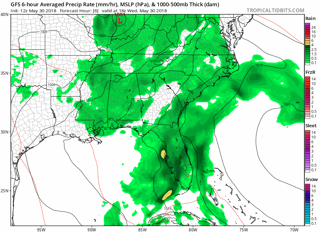
GFS MSLP and Precipitation Type Loop from May 30th, 2018 Until June 4th, 2018:
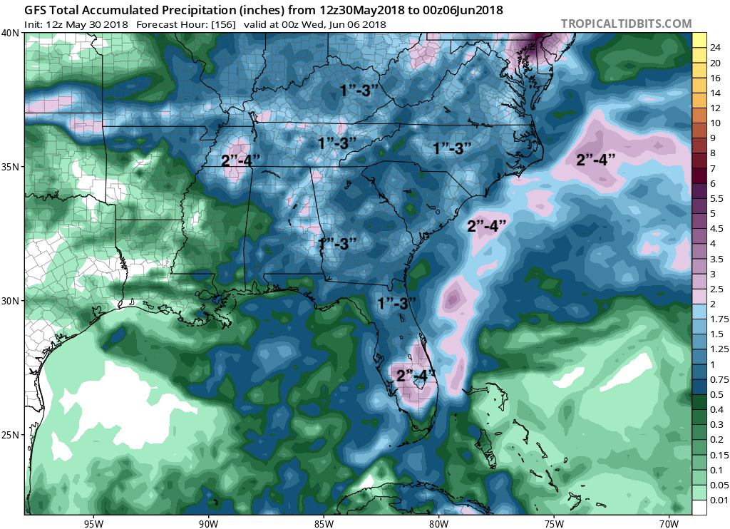
Minor totals are expected over the next 5 days, but with the ground already drenched flooding rivers and mudslides in the valleys and mountains are very likely to continue.
GFS Total Accumulated Precipitation Until June 5th, 2018:
The pattern looks to flip as we head into the middle of next week, but we will keep you updated!
If you or anyone you know of needs forecasting assistance, please recommend them to us as we will cater to your needs on forecasting! Click the link below to sign up.
-Alex B
You must be logged in to post a comment.