
Most of May has been warmer than average, and also very humid. We can’t seem to shake the muggies this month, and that’s how we will finish out. For the rest of this week, moisture will stream up the East Coast and will supply the fuel needed for downpours. Alberto is still impacting parts of the western Carolinas with scattered severe weather.
This pattern minus the severe weather will continue this week with flow from the south. We can expect flash flooding across the Southeast in any downpour.
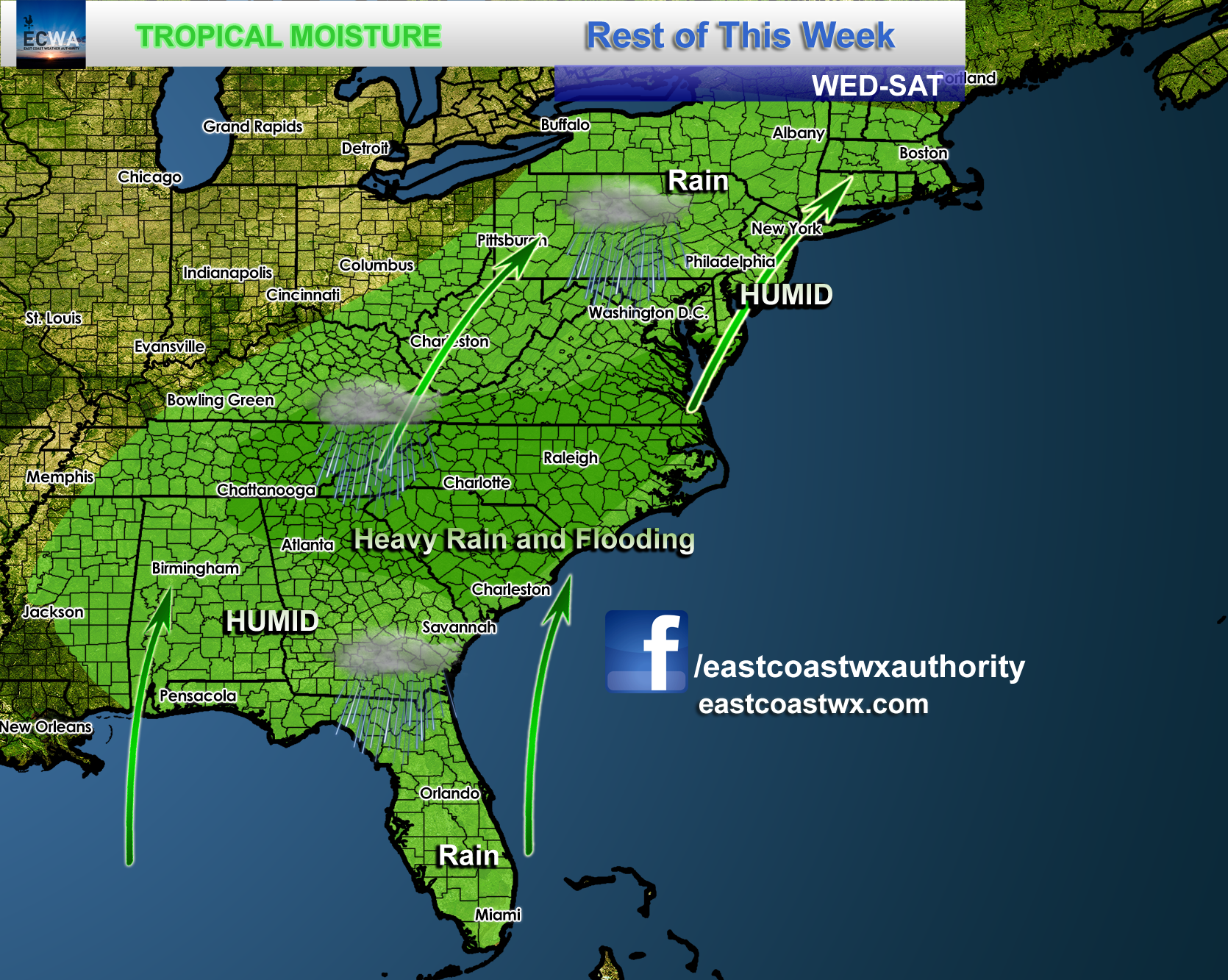
Rain totals between now and Saturday will widely vary, but any given location could get up to an inch. Any heavier rain will put down much more and faster. Don’t drive into flooded roads, but rather turn around The frogs and other insects will be “chirping” across the South tonight and every night this week.

Washington, DC and perhaps Ellicott City will experience more flooding downpours. Areas in western NC will continue to receive heavy rain in areas where they don’t need it. There are already emergencies occurring due to the flooding. This pattern looks to keep into early June, and perhaps the entire first week of June. While it will be quite humid and feel like Florida, the rain and clouds will keep temperatures below normal for this time of year.
-Mike G.
If you have not signed up for our services yet, please have a look. Thanks! >>> ECWA Professional Services
You must be logged in to post a comment.