
All throughout the month of May the lower 48 has been baking in summer heat. The continental US has been stuck in this ridge since the beginning of May. This pattern has left many to believe that we are in for a brutal summer when it comes to the heat. The pattern is finally going to break as we begin the month of June.
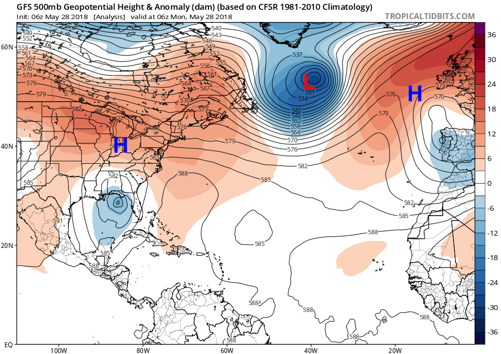
The pattern has been blocked as an upper level low established itself over Greenland for the majority of May. This upper level low has brought record snowfall to places in Canada. While the continental US and Europe have been baking underneath an upper level ridge.
GFS 500mb Heights forecast for 6z MON May 28th, 2018:
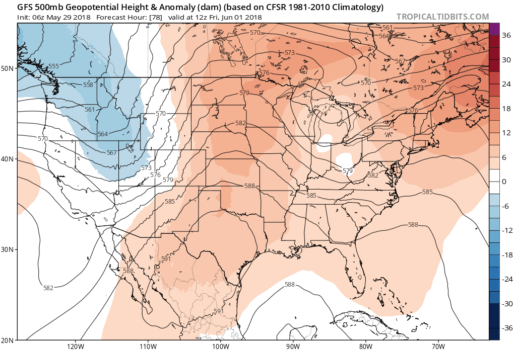
As we head into next week the pattern is going to break, allowing the Eastern half of the US to cool off as we kickoff the month of June.
GFS 500mb Loop from June 1st, 2018 until June 11th, 2018:
GFS 2m Temperature Anomaly for TUE June 5th, 2018:
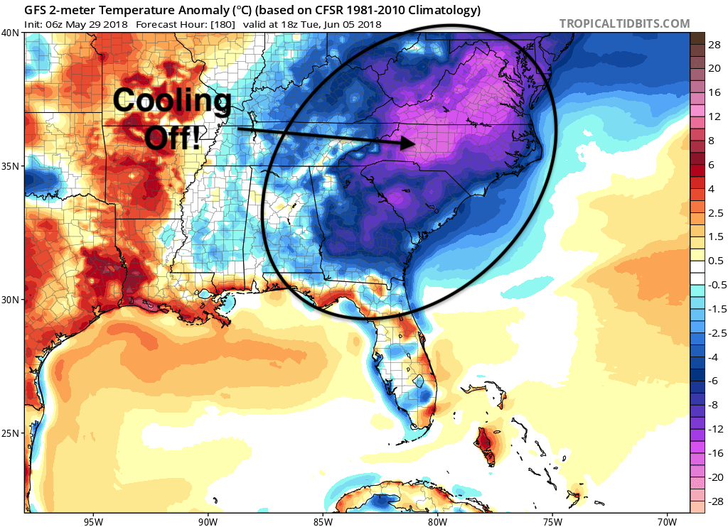
We will finally be cooling off across the Southeast as we start the month of June, bringing relief to many from the sweltering month of May. Make sure you stay here with us at East Coast Weather Authority as we keep you updated for what other nature brings you next.
Also, if you or anyone you know of needs forecasting assistance please sign up or let them now of our forecasting updates in the link below!
-Alex B
You must be logged in to post a comment.