
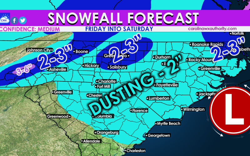
There will be more snow Friday into Saturday this week, and it seems like it’s on schedule. Snow amounts may not be as high as our last storm for some. The timing of the storm is Friday night and into early Saturday morning. Snow will continue to fall in Northeast NC until around lunchtime Saturday.
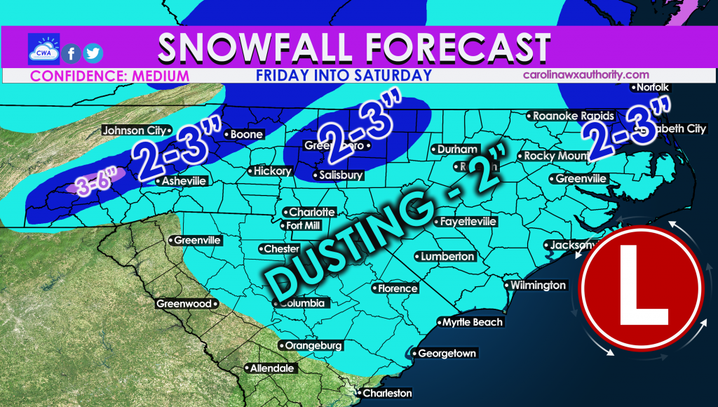
Snow amounts will be less as you go south. Charlotte and Raleigh may pick up more than Columbia and Florence. Some places along the coast either MAY or MAY NOT see flakes, but the possibility is certainly there for places like Wilmington.
Some patches across the NC Piedmont could pick up 2-3″ in heavier snow bands. The mountains will only be on the higher end of the recipients.
Southeast Virginia may win out on this one. This storm will be a coastal storm.
Get ready for more places to close Saturday morning. It will get cold behind this system after it leaves, so a re-freeze is likely Saturday night for most.
Friday night is not a good night for travel, and neither is Saturday! Check your local NWS for all travel advisories and use them for official decision making.
You must be logged in to post a comment.