
There is no question that we will have a warm Christmas Eve and Christmas Day. Rain will overspread our region tonight and into Monday, and into early Christmas Eve. Then we should dry up. But the question is, how will we start 2020?
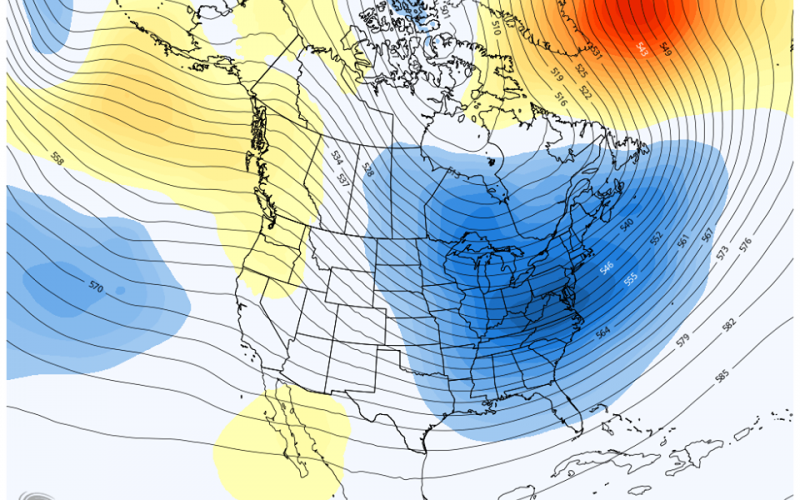
The pattern is looking more favorable for cold and snow as we start the new year. December did not play out to be too active, which was along the lines of our thoughts. January and February will be our active months, and it looks like January will start out with below-normal temperatures and we could even see a storm somewhere, but it is not clear exactly where just yet.
With the colder air in place and an active southern branch of the jet stream, our chances for the white stuff will go up. Greenland blocking is expected to return, which favors an active storm track up the East Coast, and allows cold air to spill into the Southeast.
We think that the warmer Christmas temperatures will fade into the past as the pattern could do a complete flip. Our Winter Outlook still stands at this time, and no changes are needed for now.
-CWA