
TROPICAL STORM NESTER LIKELY TO BRING MEASURABLE RAINFALL SATURDAY INTO SUNDAY
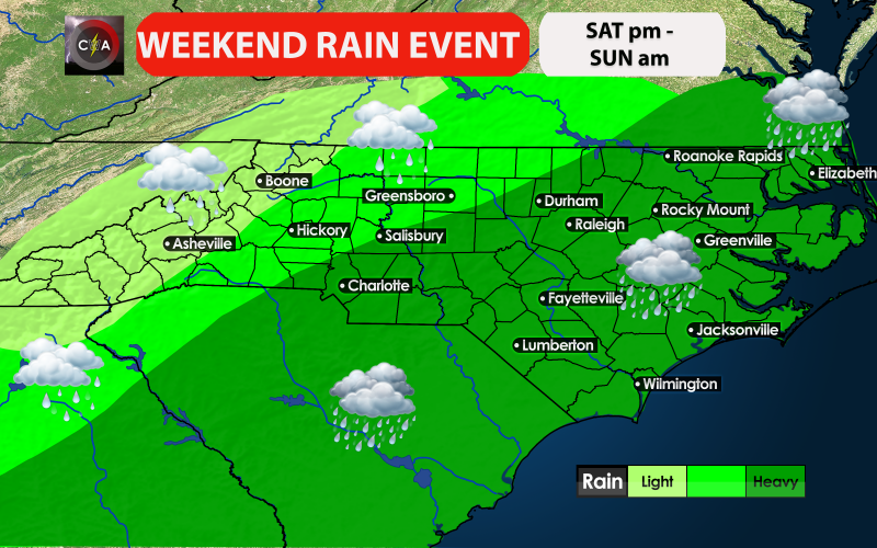
Potential Tropical Cyclone Sixteen is expected to mature into a tropical storm over the next 24-48 hours and will make landfall on the Gulf Coast Friday night into Saturday, with heavy rainfall developing over the Carolinas as early as Saturday afternoon. Rainfall will be heavy at times, especially late Saturday into early Sunday, before the system exits the East Coast. Rainfall will be heaviest along and east of Interstate 85 from Charlotte eastward with the heaviest amounts likely in Eastern Carolinas. Localized flooding is possible inland, but coastal flooding is more likely for the Eastern Carolinas. Do keep in mind that gusty winds may also accompany the system, and a low severe risk on the eastern quadrant, but that is something we will access in a separate synopsis.
The bottom line is that we can expect more beneficial rainfall for much of the Carolinas, which will continue to aid in the drought relief, but we also have some concerns in the flooding and wind department to keep a close eye on. Stay tuned here on the site, as well as Facebook, Twitter, and Instagram.
-Jesse
Carolina Weather Authority