
Tropical Storm Sally was born today, and is getting cranked up to start wreaking havoc in the Gulf. She will be a slow moving storm, so it will be some days ahead before she finally makes landfall. That may not be good, since that means she has more time to strengthen over warm water.
According to the National Hurricane Center, Sally is expected to come close to New Orleans by 8 am Tuesday. She is expected to be a Category 1 hurricane. We think that rapid intensification is possible, so a 2 is not out of the question.

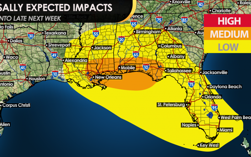
As of now, low impacts are expected in the yellow in the form of flooding rains, which could cause ponding on roadways and worsened driving conditions, along with some light winds. However, in the orange, medium impacts are expected in the way of extremely heavy rain fall, very high flash flood threat, and storm surge. Also, winds will at least be tropical-storm force in excess of 35 mph, but will be in excess of 75 mph closer to the center of the storm.
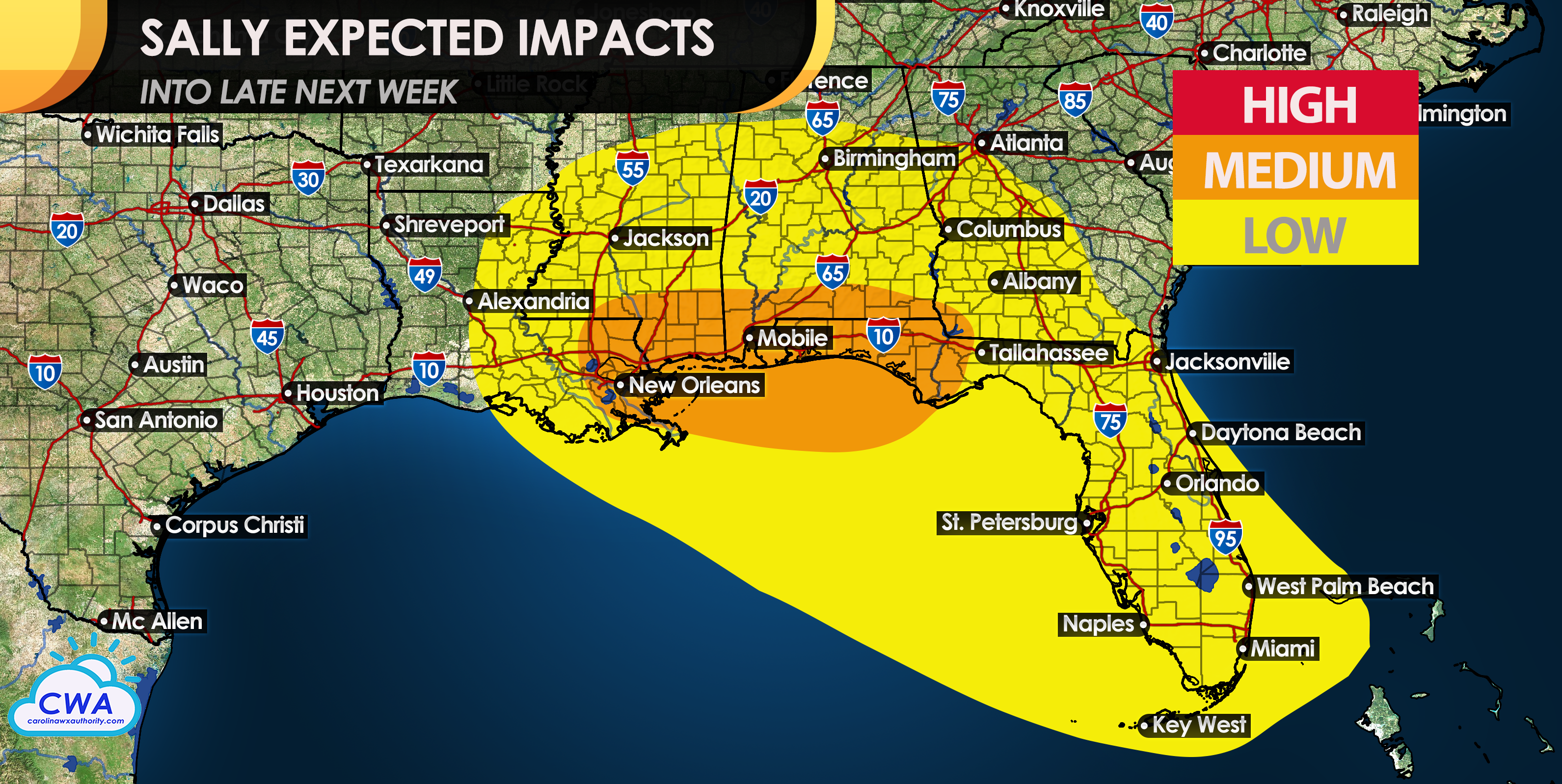
As of now, the official forecast is calling for a Category 1 storm from the NHC, but we are thinking a 2 is possible as rapid intensification is favorable for this storm as it approaches the Gulf Coast. We may need to add “HIGH” impacts in the coming days.
Stay tuned right here for any changes!
-CWA
You must be logged in to post a comment.