
As a Nor’easter just passed through the Northeast bringing cold rain to the mid-Atlantic and wet heavy snow to higher elevations in the Northeast, we are already gearing up for the next Nor’easter that will look to wreak havoc to end the week.
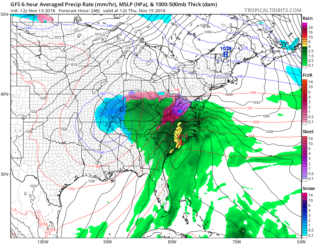 To start Thursday morning when the low pressure system begins to move into the colder air in place in the mid-Atlantic, in the mountains in west Virginia, Virginia, and North Carolina will experience heavy icing.
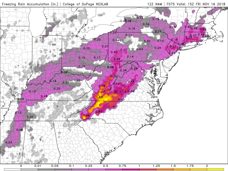
Freezing rain could produce more than one inch of ice in these locations, although one inch of freezing rain would be a stretch however it is definitely possible. This amount of ice would be devastating causing widespread power outages and downed trees.
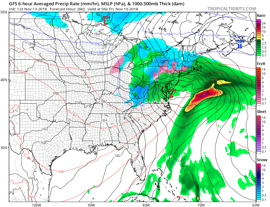
As the Nor’easter reaches the northeast the low will be deepening just off the coast of New Jersey further intensifying the storm. By overnight Friday snow will begin to fall in the Northeast with isolated patches of freezing rain along the rain/snow line. The snow should be heaviest closest to the rain snow line along central New York, Vermont, New Hampshire and Maine.
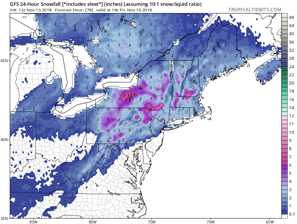
By Friday afternoon the Nor’easter should have moved out of most of the Northeast with the exception of Maine. Storm total snow accumulations should be around 3-6 inches for a majority of the Northeast with localized higher amounts in higher elevations. Keep in mind this will be a wet heavy snow with temperatures near freezing, so snowfall amounts could be lower if a brief warm up brings patches of rain or freezing rain. Check back here at East Coast Weather Authority for your latest update on weathers worst.
-Benjamin Charles
You must be logged in to post a comment.