
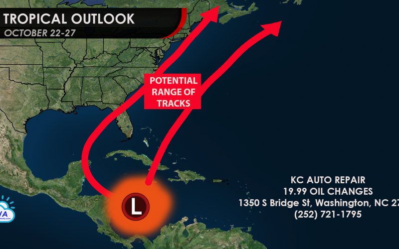
We could see an interesting 4-9 days from now in the tropics. While this time of year is not extremely active for hurricanes, they are not completely uncommon. What we could be looking at is an area of low pressure just off the coast of Central America. This area of low pressure will deepen, and as a result a tropical depression could form. This system could become either a tropical storm or hurricane in the coming week or so. The tracks are fairly uncertain, but should range from the Gulf side of Florida to well out to sea, as we are hoping for the latter. However, this tropical system could track along either arrow below, or somewhere in between.

Currently, only the Canadian model is showing the threat, but other major models should start to catch on as we get closer to the 22nd. This model keeps it offshore and not really a threat to the East Coast.

This storm could not pose a threat to the East Coast other than some rip currents and big waves, but we need to watch closely just in case over the next 4-9 days.
Stay with us here at Carolina Weather Authority as we will bring you updates regarding this potential system.
You must be logged in to post a comment.