
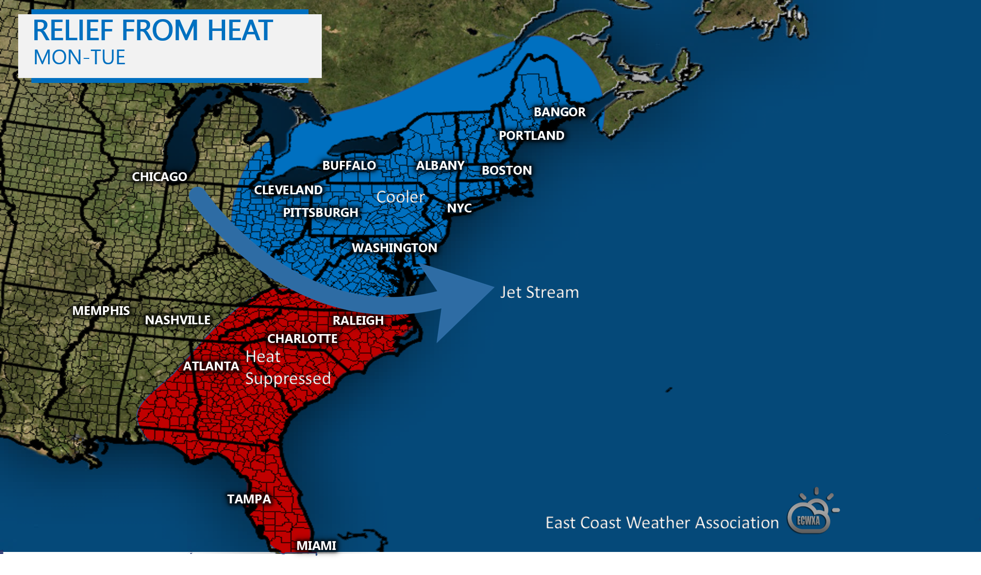
If you can’t stand the heat, and you live up North, chances are you won’t have to suffer for long. A temporary cool shot is headed to New England and the I-95 Corridor for Monday and Tuesday after a cold front pushes through. This will set the stage for severe thunderstorms including possible tornadoes. It won’t be a huge relief from the heat, but a noticeable difference from the heatwave we are having now.
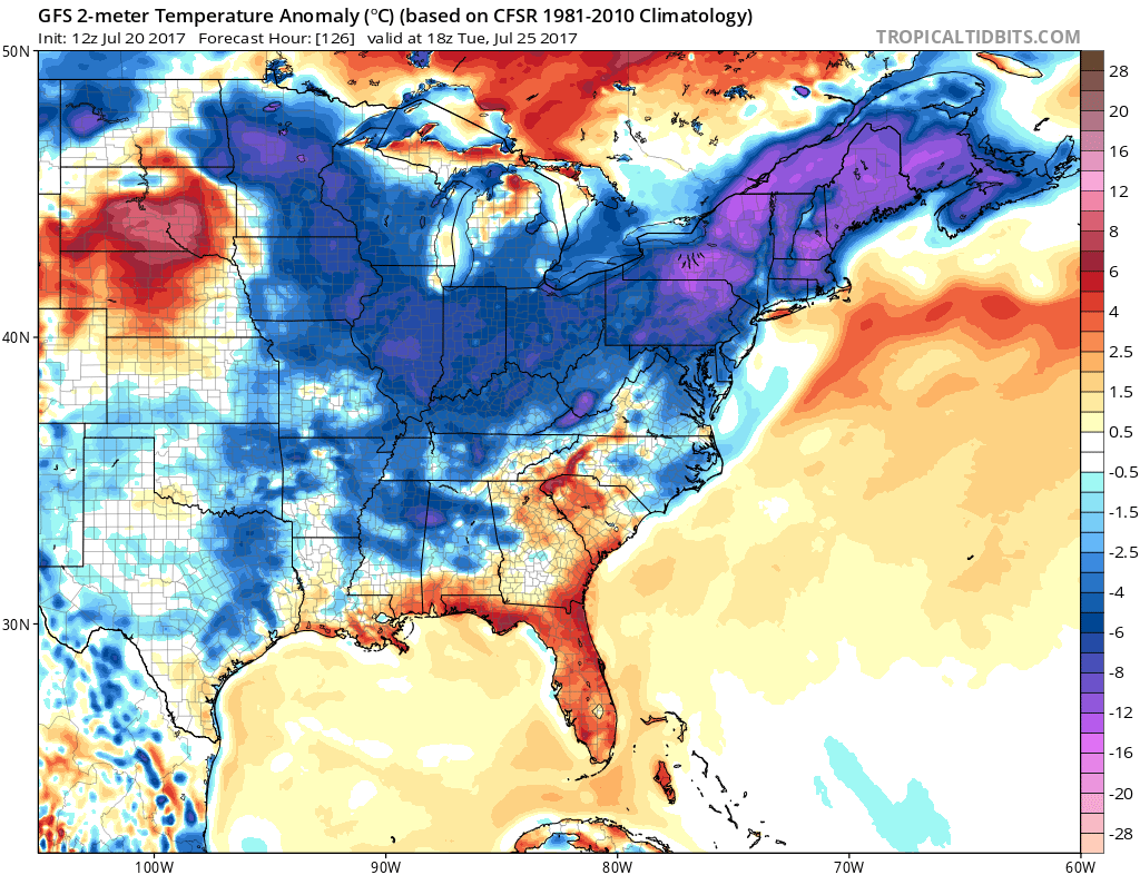
The GFS temperature anomalies for Tuesday look downright refreshing. Again, in the Southeast, the change in this pattern will hardly make a dent. It is still summer down there, and the temperatures will continue to reflect that. Although they will see a break from the upper 90s!
You must be logged in to post a comment.