
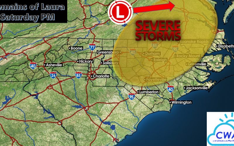
What was once destructive Category 4 Hurricane Laura in southwestern Louisiana Thursday morning has weakened into a remnant low pressure system Friday over the Tennessee Valley. The remnant low will track into Virginia Saturday afternoon and produce locally gusty winds and heavy rainfall near and to the northwest of the storm center during the morning in the Appalachians and during the afternoon just to our north.
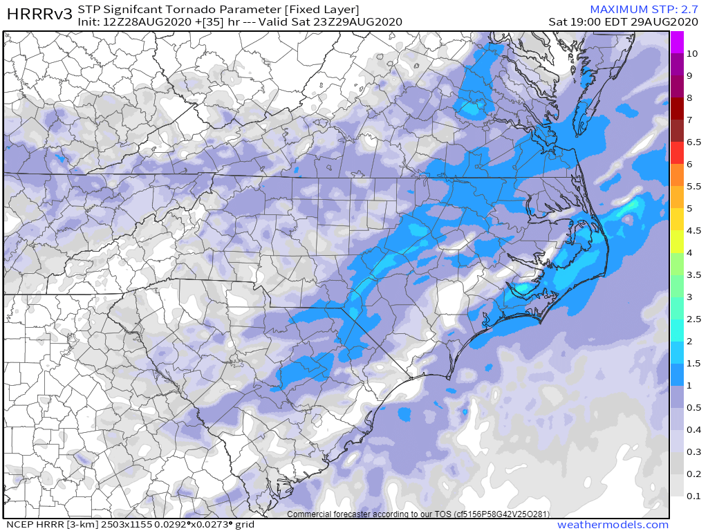
However, jet stream energy accompanying a strong trough will add wind shear in the upper levels to a warm, humid air mass south and east of the storm track, bringing the risk for severe weather in the afternoon Saturday across the Piedmont and Coastal Plains. Currently the Storm Prediction Center has a slight risk (level 2 out of 5) for severe weather over the eastern half of the region, including a 5% chance for tornadoes. Outside of thunderstorms, winds could gust to 30-40 mph, but only if the cloud cover breaks.
The best wind shear will remain north of the region, but any amount of sunshine Saturday morning could add enough instability for scattered severe thunderstorms that move quickly from west to east. The timing for these will be around lunch time east of I-85 and heading into the Triangle and up to Richmond, and in the early to mid afternoon in Southeastern Virginia and areas east of I-95. By late afternoon and early evening, the severe weather threat should diminish as storms approach the coast. However, there’s a slight chance that a second round of storms could follow a few hours behind the first, and any sun in between the two waves could fuel a more significant line of severe weather.
Models are generally a little fast with the storm for the risk for widespread severe weather as timing would need to slow down by a few hours for there to be an enhanced severe weather risk. But if that does happen, we may need to be alert for multiple severe thunderstorms including a few low-end (EF-0 and EF-1) tornadoes to quickly form.
Finally, rainfall amounts look to stay low east of the mountains, so flooding is not expected for most of the region. However, it’s been such a wet summer that it won’t take a lot of rain and wind to cause tree limbs to come down, and scattered power outages to become possible. Be sure to keep it tuned to our Facebook page for the latest radar updates.
-CWA
You must be logged in to post a comment.