
COLD FIRST WEEK OF APRIL
Showers and even heavy gusty thunderstorms move through late tonight and into early Friday morning, and will be associated ahead of a cold front. Some of these storms could be on the strong side so don’t be surprised if there are Watches and Warnings.
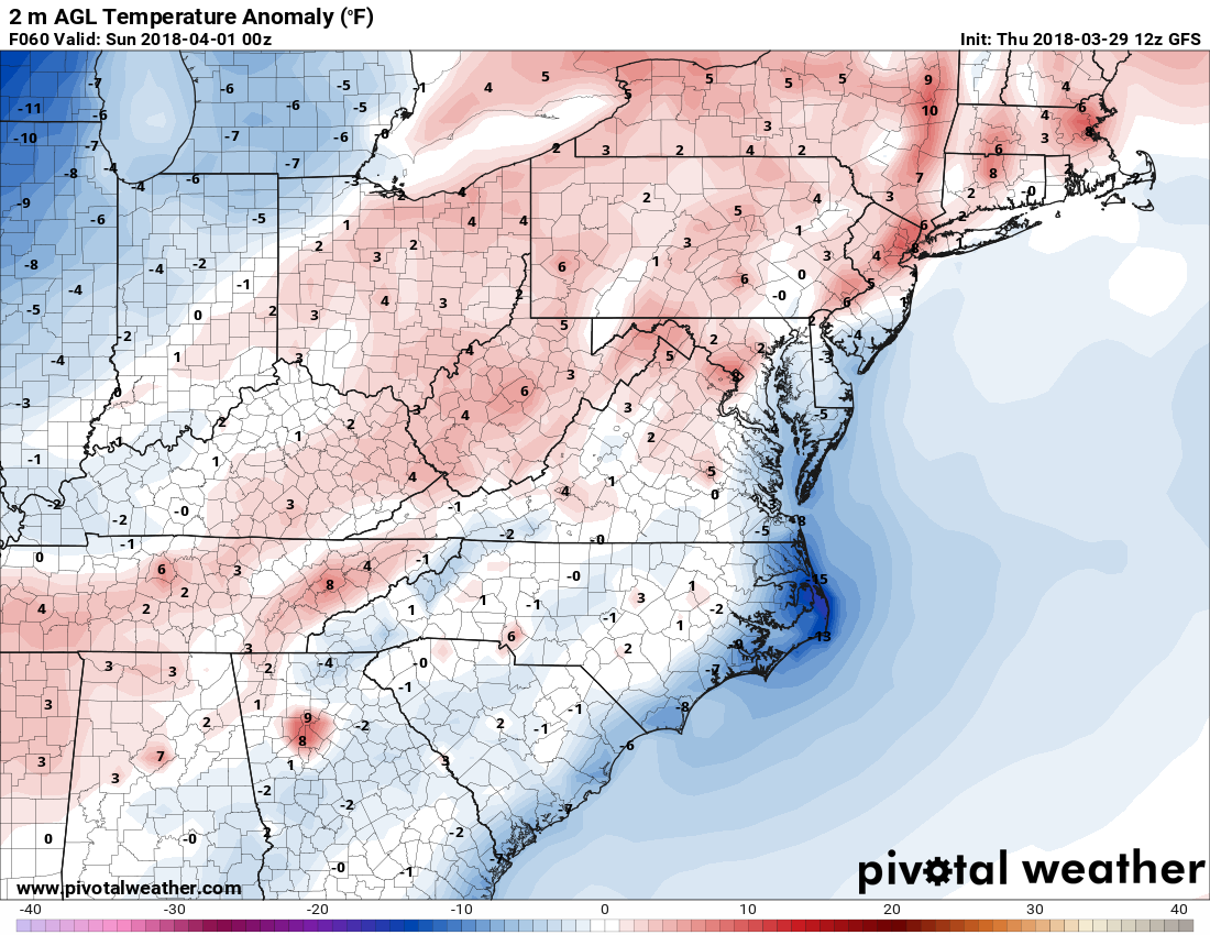
Behind this front, seasonable temperatures will filter in for the Holiday Weekend. We are not looking at any hot or cold temperatures which is completely normal for this time of year. Departures from normal for Saturday are almost around 0.
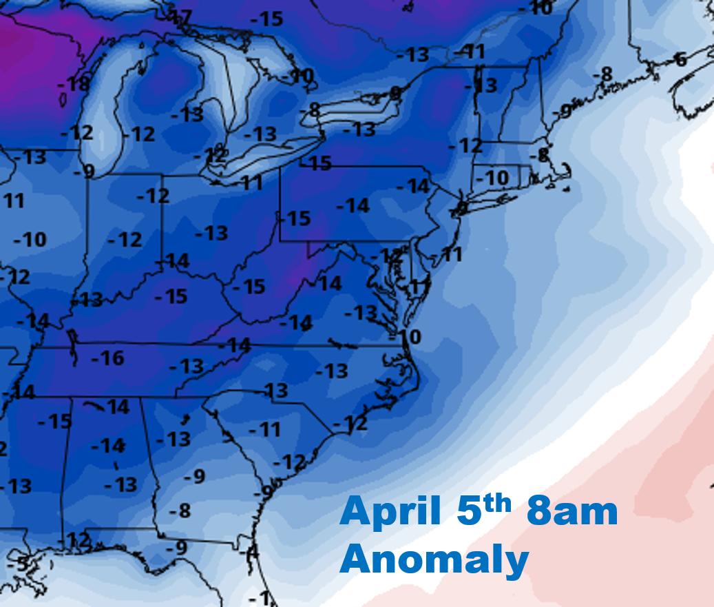
However, on or around the 5th next week is when we could see some significant changes. Temperature departures could be as much as 13 degrees F below normal on average across the board. GEFS ensembles are painting a chilly picture on or around the 5th.
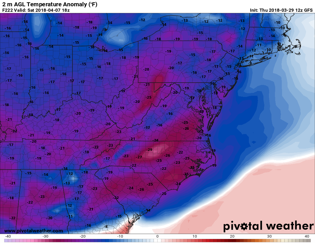
The GFS operational has downright COLD for many in the East around the 7th. This means it’s still not safe to plant your gardens yet. Also, apple, peach, and orange crops should try to be protected from freezing temperatures. Some locations could be looking at 29 degrees F below normal! This is valid for next Saturday.
Looks like those summer clothes are going to be on hold for a while! Other than the brief warmups we will experience, but they will only be temporary.
-Mike G.
You must be logged in to post a comment.