
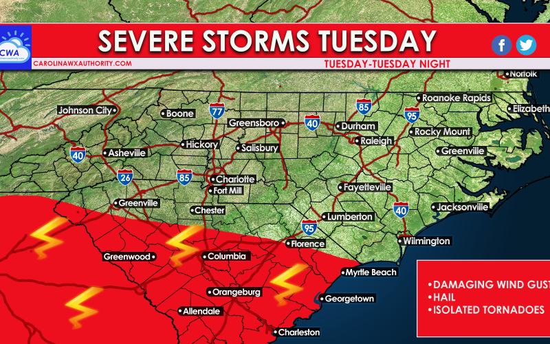
All eyes to the sky on Tuesday as a convective storm system moves our way across the Deep South. For Tuesday the severe threat should be limited to mainly South Carolina and Georgia, however anyone can see a severe storm or even tornado outside of the red shaded area.
The main threat is damaging winds (80 mph + is possible) and hail, some large. There is also an isolated tornado threat. We are not expecting a widespread tornado outbreak, but rather isolated spin-ups. Please heed all warnings and watches issued by your local NWS office. They are to be considered official information for any action items and life-saving and property-saving information.
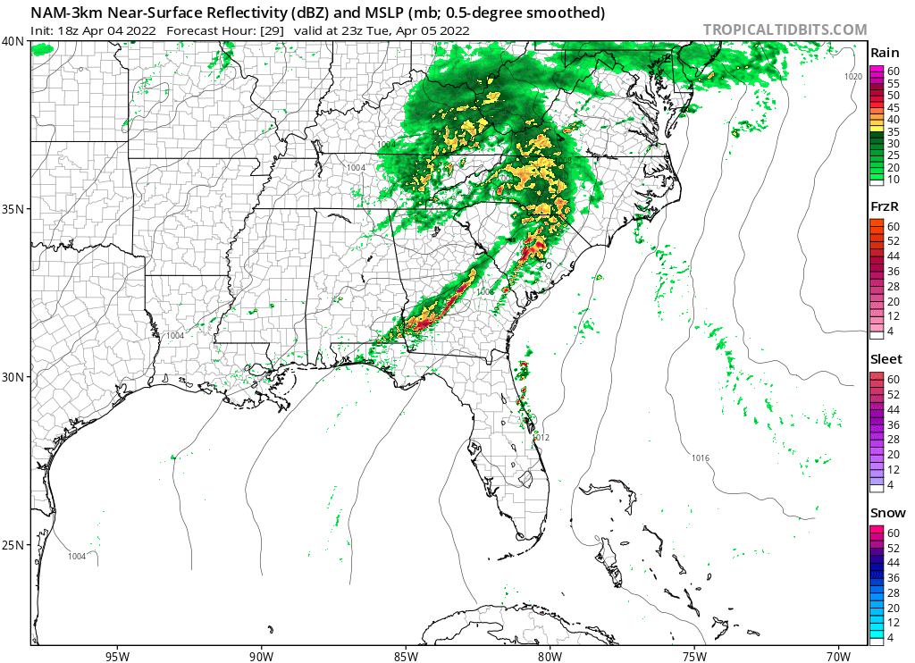
The timing for Tuesday’s event is from the late afternoon into the early evening hours. Below is the futurecast radar for 7pm Tuesday.
This can be a potentially dangerous situation for anyone in a storm’s path, as any storm can turn severe tomorrow (Tuesday).
However, all will be fine for those that have a source for severe thunderstorm and tornado warnings.
Again, take all updates and warnings from your local NWS seriously (as always).
You must be logged in to post a comment.