
Severe weather is likely across much of the Carolinas today as a cold front swings in from the northwest. Severe Thunderstorm Watches are already in effect for much of the forecast area. We’ve put together a zonal severe weather outlook to help determine the extent of the severe weather threat in all areas of the Carolinas. Take a look.
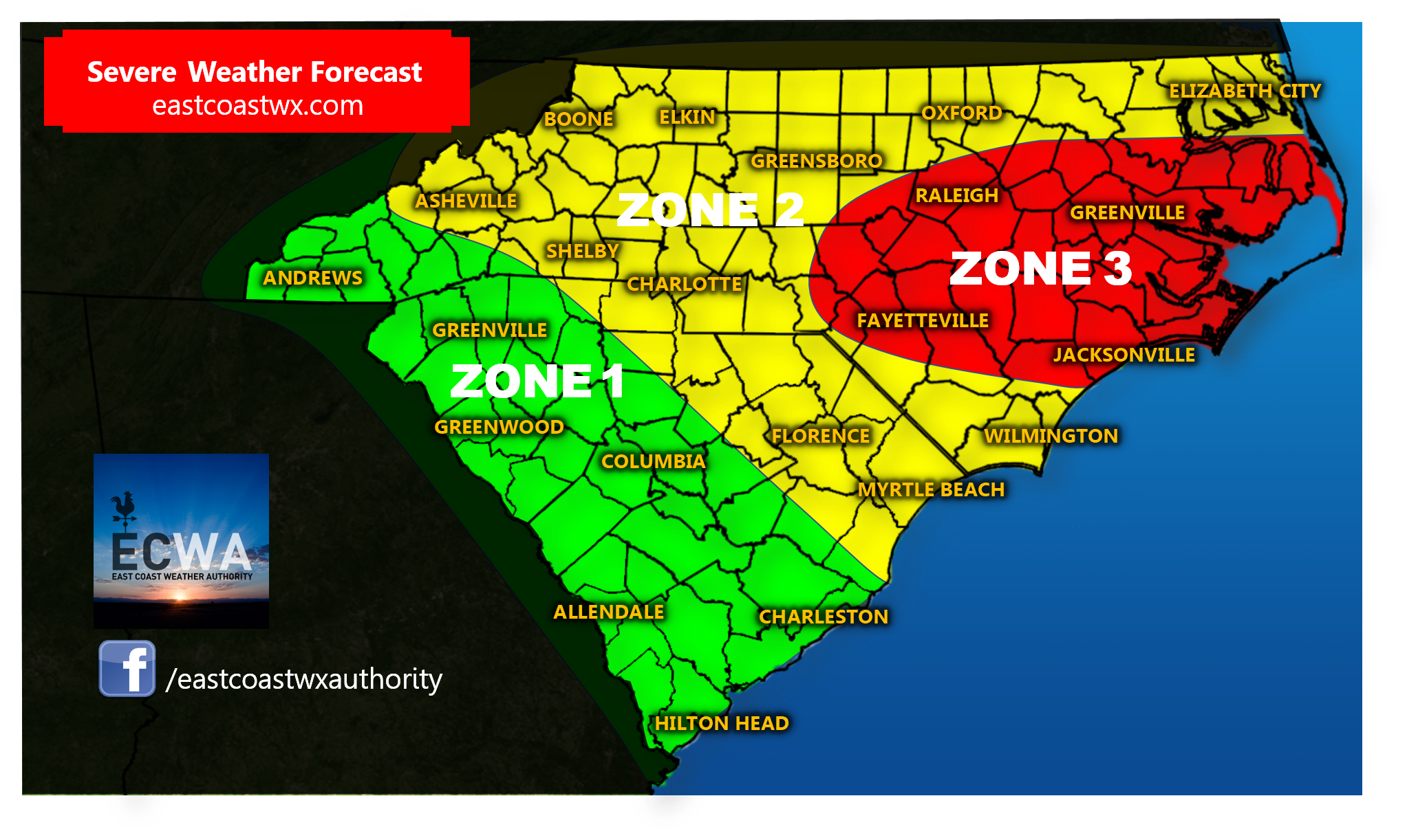
Zone 1: Low chance of severe weather in this zone. A few widely scattered showers and storms possible. A strong storm or two cannot be ruled out with gusty winds, small hail, or a downpour, but the chance is lower in this area.
Zone 2: Higher chance of severe weather in this zone. Scattered strong to severe storms likely with damaging wind gusts,large hail, and torrential downpours possible with some storms.
Zone 3: Highest chance of severe weather in this zone. Numerous strong to severe storms with damaging wind gusts, large hail, and torrential downpours likely with many storms. The tornado threat is low, but if there is a tornado, it would likely be in this area.
Make sure to take all necessary precautions and have a way to receive watches and warnings this afternoon and this evening, and as always, stay tuned for the latest right here with East Coast Weather Authority.
|
ReplyForward
|
You must be logged in to post a comment.