
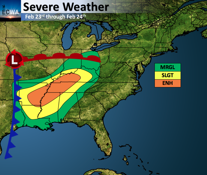
With the pattern we have been stuck in, it is only a matter of time before we see our first severe weather outbreak potential. This weekend will be the first threat. We will have a Great Lakes cutter originate from the Texas/Oklahoma panhandle, quickly intensify, and then move northeast towards the Great Lakes bringing the threat for severe weather.
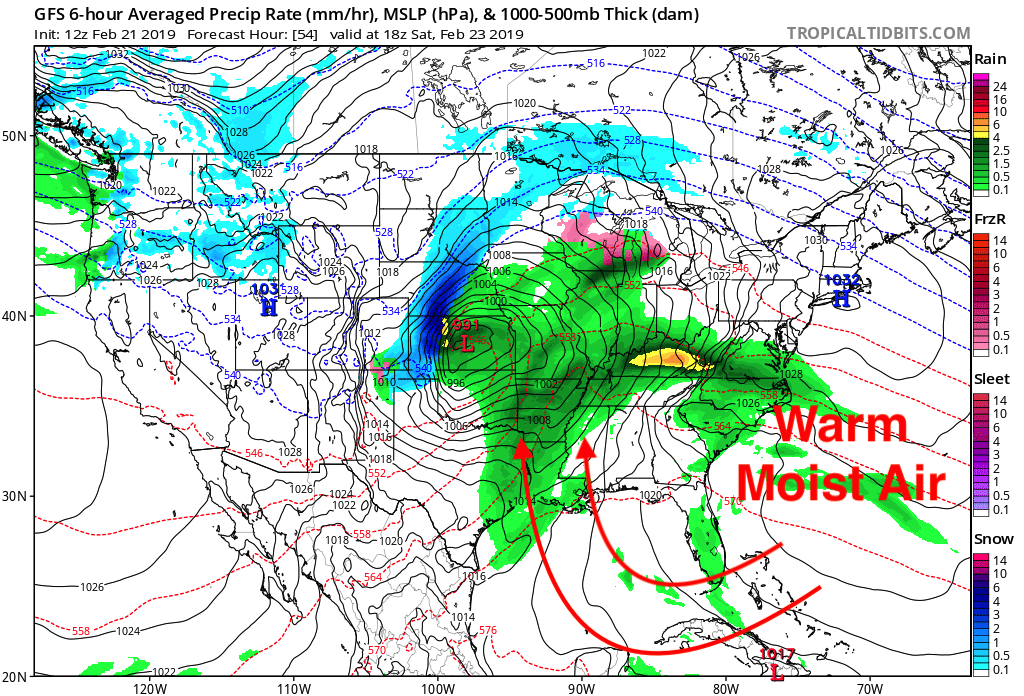
A powerful storm system will make its way out of the southern Plains and move northeast towards the Great Lakes. With it, warm and moist air will be transported from the Gulf of Mexico and into the Mississippi River Valley.
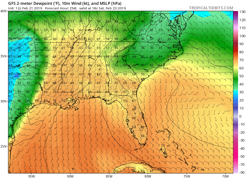
This will allow dew points to rise into the upper 60s to near 70, which will help create instability behind the warm front.
Our lift needed to initiate convection in these areas will be our cold front that will sweep through during the day Saturday.
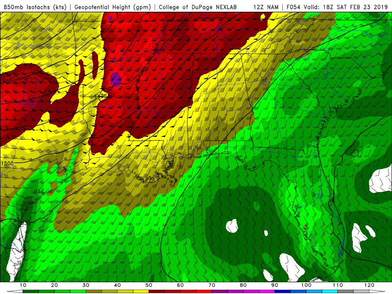
Our strengthening low pressure system will also help to mature our low level jet at 850 hPa close to 80 knots. This will create the opportunity for damaging winds to reach the surface.
Our greatest threat will be damaging winds in these areas, but there will be enough shear that has the potential to spawn a few tornadoes.
Make sure you stay here with us as we get you prepared for what mother nature brings next.
-Alex B.
You must be logged in to post a comment.