
There is a strong Arctic front heading our way, and bringing bitter cold temperatures behind. When the front finally pushes to the east of the mountains in the South, it will slow down some, allowing a wave of low pressure to from and drop some heavy snow around Raleigh and eastern NC. Richmond, VA is also in on the band of heavier snow. Overall, accumulations are expected to be on the light side, with the exception of any location receiving up to 8″.
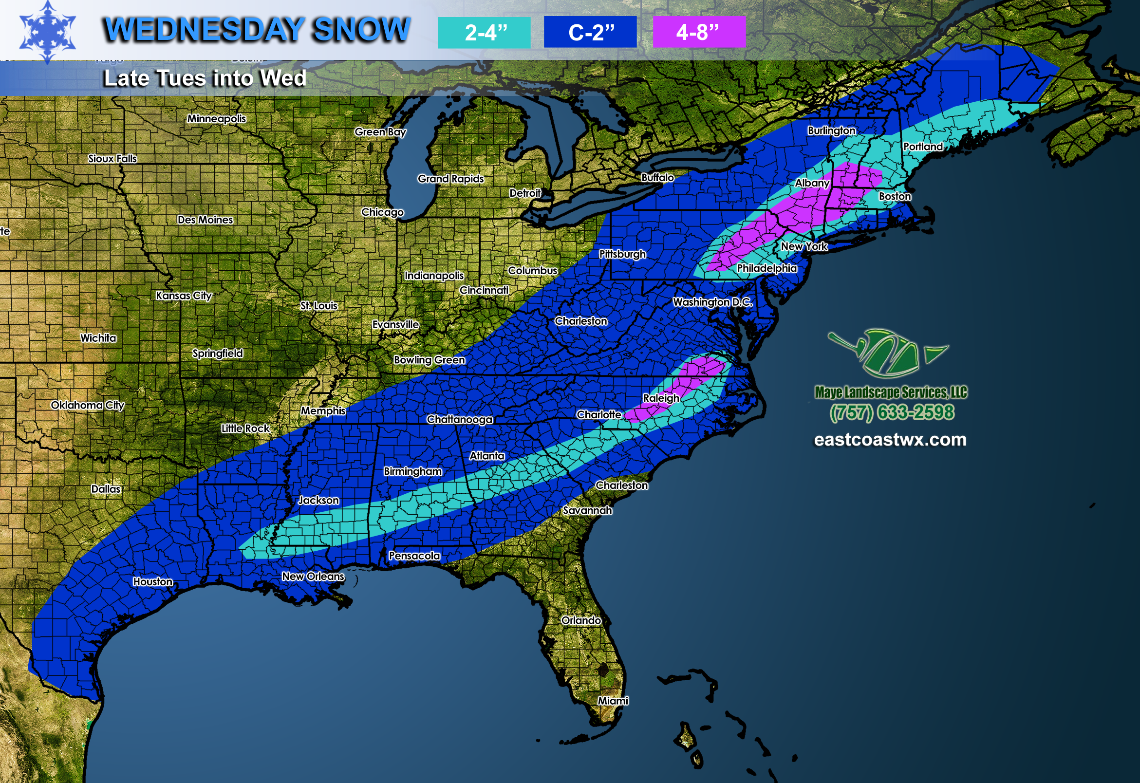
Both areas of low pressure are not expected to phase or combine, as they will drop heavier snows in separate areas. The NAM is decent at picking up on short-range forecasts as is the HRRR model. Who wins out with this snowstorm? Most likely locations in PA and NY, New England. This is where some of the most moisture and colder air will be. Also, the northern-most wave of low pressure will be stronger, thus dropping more snow.
Behind this exiting storm system, the bitter cold will return. We are not expecting it to last long, since it will warm up again. But then after the 25th there is the potential for another visit from a piece of the Polar Vortex. Stay tuned for that article!
-Mike G.
Subscribe to our pro services or advertise on our site >>> CLICK HERE
336 268 0201 Tommy white
![]()
You must be logged in to post a comment.