
WINTER STORM OF 2-20-2020
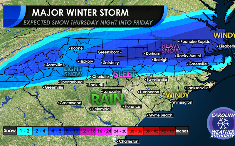
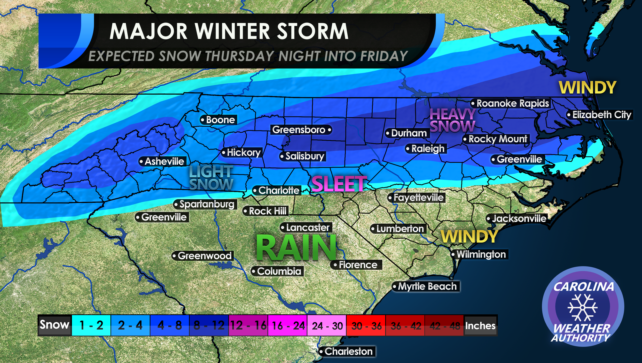
Here’s our snow totals for Thursday night into Friday’s storm. There will be a lot of sleet along the southern edge of the snow shield, and it will mix with rain. Anywhere along the southern edge may only see a dusting or a coating of sleet.
The winners will be from Salisbury NC to the coast, and up into Southeast Virginia. The map below explains it all, what type of precip certain areas can expect and snow amounts. It will also be windy along the coast as this coastal system will get its act together overnight Thursday into Friday.
Timing: We are looking at later in the afternoon on Thursday and lasting into the early morning hours on Friday. It will end from west to east, so snow will end in western locations first before ending in locations east.
Schools may let out early on Thursday and may be cancelled on Friday. Please don’t leave all at once Thursday as this could create very bad traffic jams on the highways and roads!
And above all, please heed your local NWS office warnings and advisories and stay SAFE!
-CWA
You must be logged in to post a comment.