
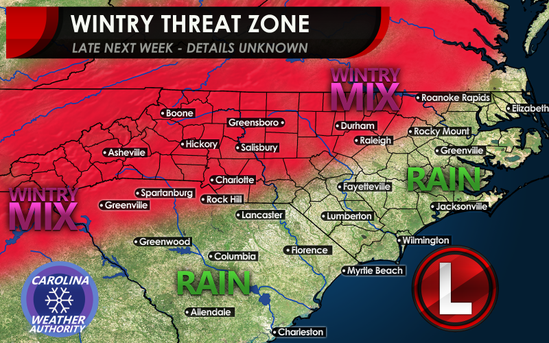
SOUTHEAST SNOW/ICE STORM?
It is still a week away, and things could change, but we have been watching a potential favorable pattern for something happening in the Southeast next week. Since we are over a week out, the exact details are not known, so please don’t take anything in this article verbatim. Based upon climatology and the pattern that is setting up for mid-next week, there could be some kind of potential storm. Again, exact precip types are not known although wintry precip is on the table. If anything, based on past odds, many people would see a wintry mix across the Piedmont of NC and SC, and also GA. Farther to the west and north, and in the mountains it would likely be mainly snow. Where it is warmer, along the coast and to the south and east, the precip types are typically rain. The only exception is if it were some kind of freak event, which has happened, but not often.
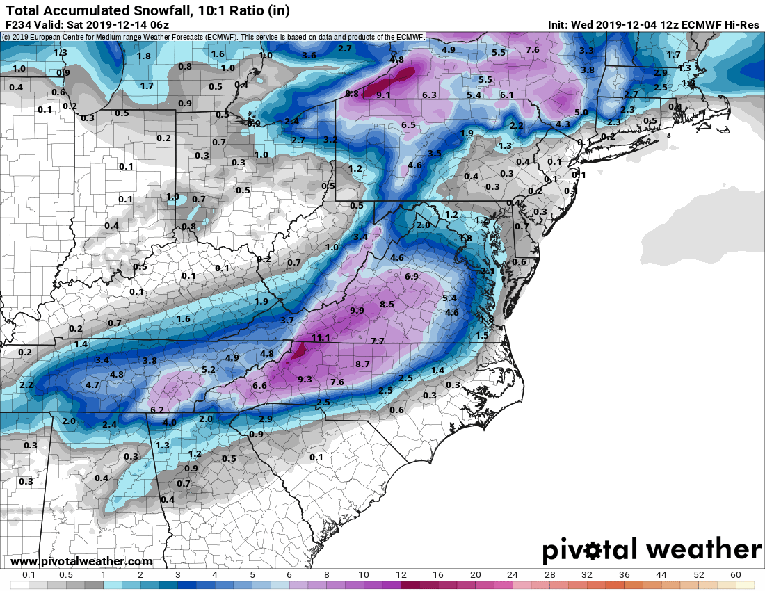
What has a lot of pages buzzing is the latest run of the hi-resolution version of the Euro model. This run has laid down a swatch of snow from Georgia to Virginia. Again, this is likely NOT ALL SNOW. EVEN IF IT WERE A WINTER STORM, WE WOULD HAVE TO ACCOUNT FOR SLEET AND FREEZING RAIN WHICH WOULD DRASTICALLY REDUCE SNOW TOTALS. That is why we are saying wintry precip and not snow. Please do not panic and run for bread and milk, since it would be expired by the time the POTENTIAL storm would even get here
The takeaway idea from this article should be that there COULD be some kind of storm moving across the southern US next week, and that’s really all for now. It could just be a cold rain for all involved, and no snow, so that is certainly on the table. What we mean by this is that by this time next week, the models could drop the storm completely. So we will have to continue to watch.
Just keep an eye on it over the next week or so, as it will likely change MANY times. It would be cool to get some snow (or not, I might move to Florida), but things don’t always work out and it could be all rain instead.
Just have fun watching to see how this situation plays out, if it does! In the meantime, check out our other article discussing the potential favorable pattern here >>> Upcoming Snow and Cold Chances for the Carolinas
Also, here is the hi-resolution Euro model from pivotalweather >>> https://www.pivotalweather.com/model.php?m=ecmwf_full&p=sn10_acc&rh=2019120412&fh=loop&r=us_ma&dpdt=&mc=
-CWA
You must be logged in to post a comment.