
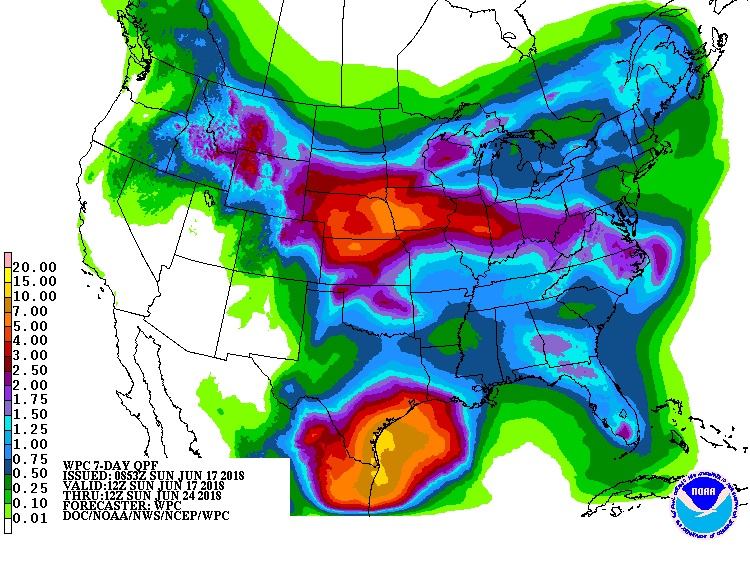
A tropical disturbance in the Gulf of Mexico will likely bring heavy rains to the Texas coast. Currently this disturbance is located over the western Gulf, and is slowly spinning just off the TX and LA coasts. Below is the graphic for rain totals over the next 7 days ending on June 24th. The Carolinas are included in rainfall expectations over the next 7 days.
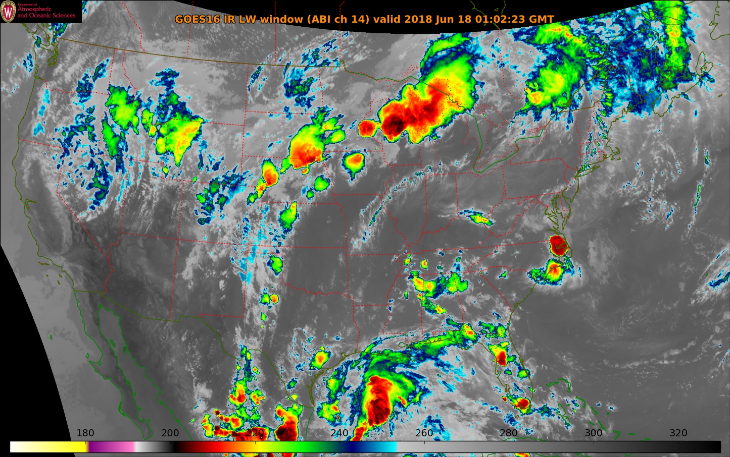
On infrared satellite, the disturbance is visible in the Gulf. It is not showing signs of organization, but rather cold cloud tops on the eastern sign signifying heavy rain. This disturbance is expected to track westward into Texas.
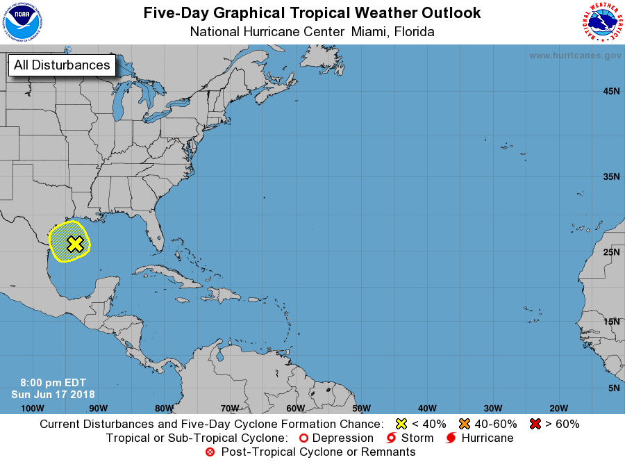
Movement is expected to be slow over the next few days, therefore when this disturbance makes landfall it will likely put down heavy rain totals. Latest NHC forecast gives this feature only a 20% chance of formation over the next 5 days. The main threats with this disturbance will be flooding rains.
Impacted locations will likely include Galveston, Corpus Christi, and Brownsville, TX.
East Coast Weather Authority
You must be logged in to post a comment.