
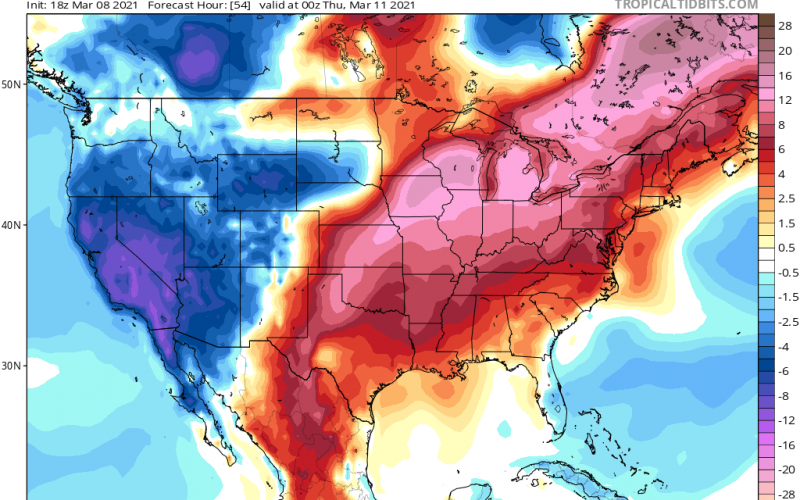
Yes, the warmup is still coming, and it will be fabulous for warm weather lovers. By Wednesday, much of the Southeast will be basking in 70 degree + high temperatures. Below is the temperature anomaly for Wednesday:
Much of the nation will be in a swath of red, which means way above average temperatures for some locations. A strong ridge of high pressure will dominate the latter half of this week.
Butt then, changes? A strong cold front could move in from the west and touch off severe storms for our region, but the details still remain fuzzy. It may just be a dry frontal passage with light rain at the most. We are entering severe weather season, so now is as good a time as any to review your plan.
If anyone, it looks like the Midwest could see some severe activity around the 15th or so, or whenever the next storm system to move in and cause temperature swings. A storm system will dig into the Great Plains late this weekend, causing snow to the north and west and severe storms across the Deep South and eastern Plains.
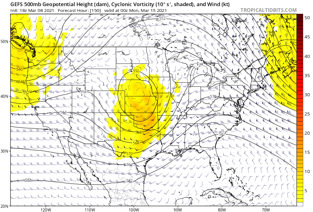
This weekend is when we could start to cloud over and then see some stormy activity move in from our south and west along a powerful cold front. It’s all just speculation for now. As a result, we could see a temporary cool-down Sunday into Monday next week, but it will be short-lived since the Southeast ridge will take over once again.
We are slowly moving into brighter days and slightly warmer days overall. As a reminder, the clocks get set 1 hour forward this coming Sunday.
You must be logged in to post a comment.