

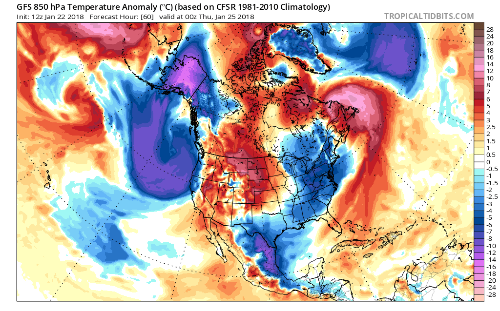
The recent warmth some may have enjoyed, however it is not here to stay. On Wednesday this week a strong storm system approaches from the west, and will draw in colder air behind it as it departs out to sea. The cold will not be extreme and will only be short-lived.
Canadian ensembles shown for Wednesday night into Thursday morning (1st image). GEFS is also on board for Thursday cold (2nd image).
Any image is clickable for larger version

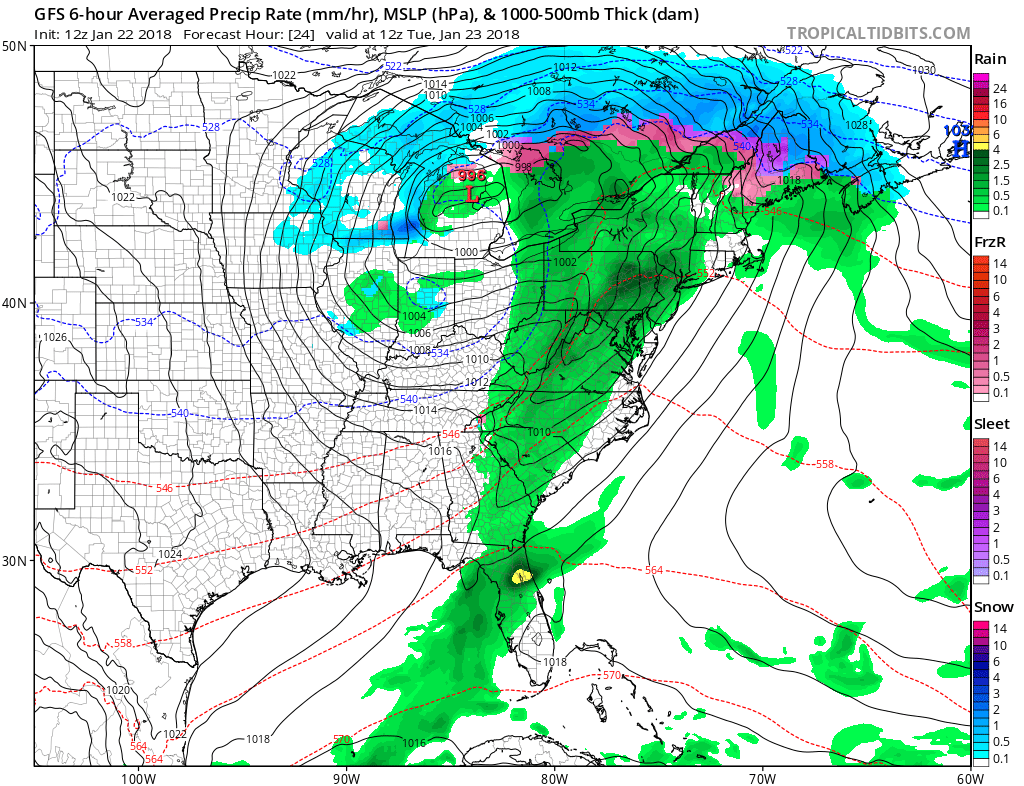
Before the short-lived cold arrives, we will experience rain with the possibility of some strong to severe thunderstorms across the South. The timing is Monday night into Tuesday. All that green is rain and embedded storms. Even if there are no storms, it will get cold and windy behind the cold front after it pushes through. Pay attention for watches and warnings from the NWS.
GFS is shown for 7am Tuesday (always keep it mind models are not perfect and this could be + or – 6 hours.
Otherwise, enjoy the relatively tranquil weather until then. After our next cold shot we will warm up once again, but that will not last. Become a member by clicking here to find out all the details and for personal updates.
-Mike G.
If you have roof damage, call below for a free estimate and be sure to mention East Coast Weather Authority.
![]()
You must be logged in to post a comment.