
Showers and storms will be likely across Virginia, North Carolina, and much of South Carolina for Friday, particularly during the afternoon and evening hours.
With a fair amount of cape in the atmosphere, there is the risk of some strong to severe storms. We can’t rule out a few super-cells as well. Damaging winds and hail will be the primary risk with any storms, as well as dangerous lightning and torrential downpours. Tornado risk is low, but not zero.
Here are the current outlooks from the Storm Prediction Center for Friday regarding the Carolinas:
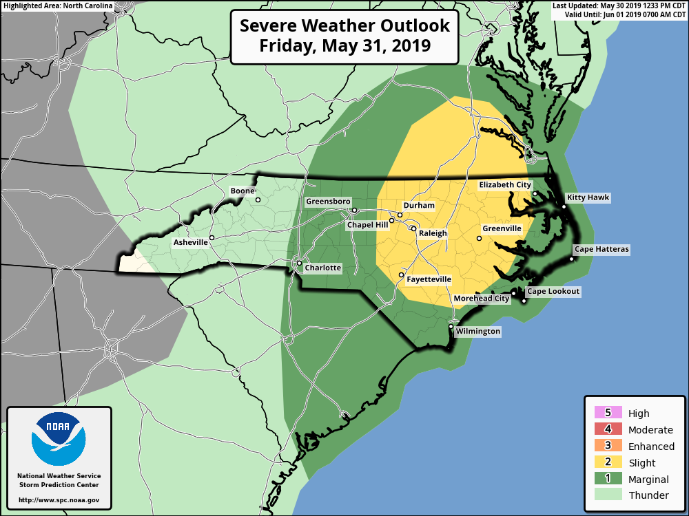
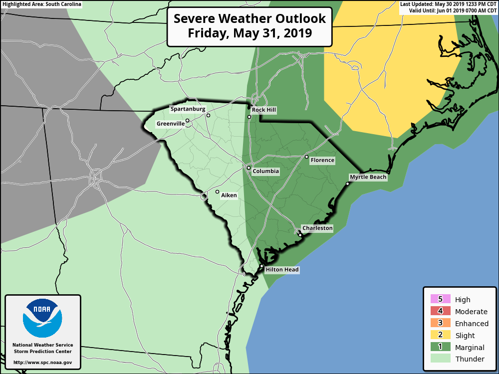
Right now, areas like Greensboro, Charlotte, Rock Hill, and Columbia have an elevated risk for a few strong to severe storms, with big cities like Raleigh and Durham right in the middle of the highest risk area. Most of the Carolinas will see shower and thunderstorm activity, whether there is any severe weather or not.
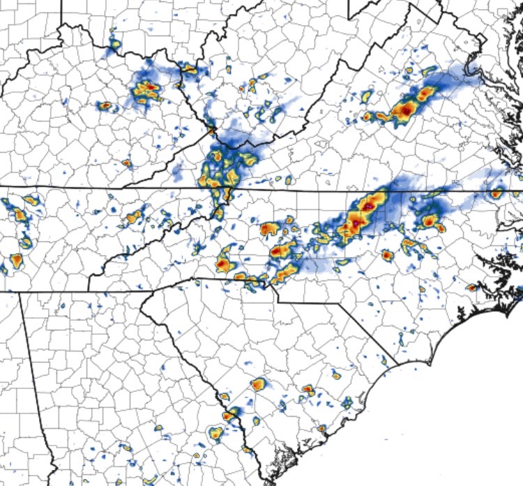
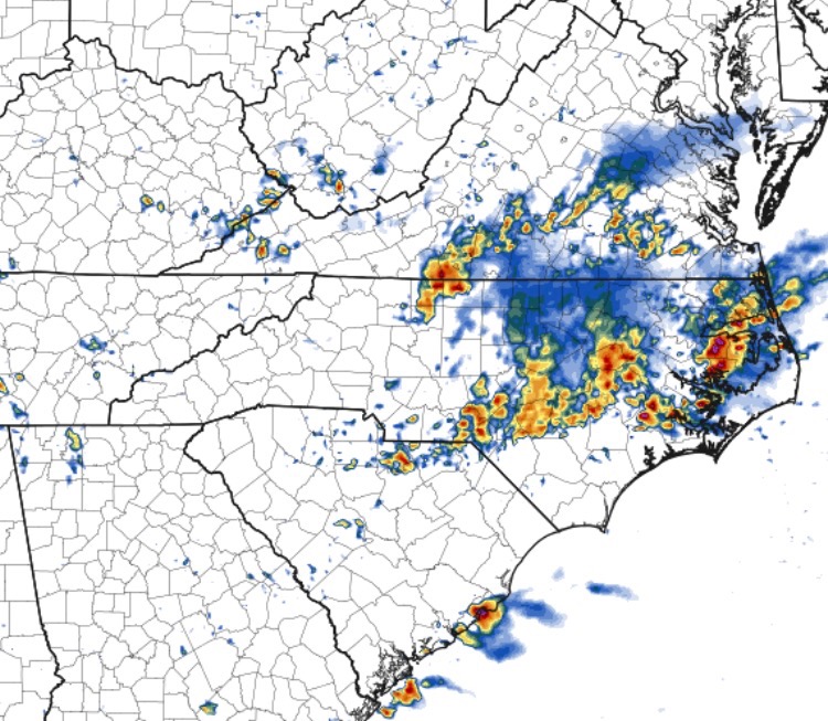
Here are the latest projected radar images for Friday from the high resolution NAM model.
Shown are projections for 4:00 PM and 8:00 PM EDT according to the latest run:
Have a way to receive watches and warnings on Friday and stay tuned for further updates, especially if you have any outdoor plans or activities. East Coast Weather Authority has you covered.
-Jesse
East Coast Weather Authority
|
ReplyForward
|
You must be logged in to post a comment.