
The heatwave already responsible for oppressive high temperatures and heat indices will crest at its peak this weekend, as dangerous heat and humidity collaborate to produce a sweltering three days for the Carolinas.
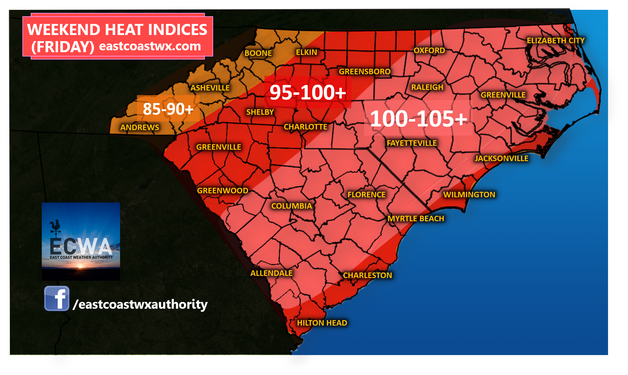
While this Thursday provided a break for a few areas in terms of scattered showers and storms to dent the heat, Friday will arrive with much less coverage in rainfall and a lot more coverage in oppressive heat. Temperatures look to be in the 80’s to near 90 in the mountains with 90’s likely elsewhere and a few isolated locations near 100. Take a look at our forecast heat indices for Friday:
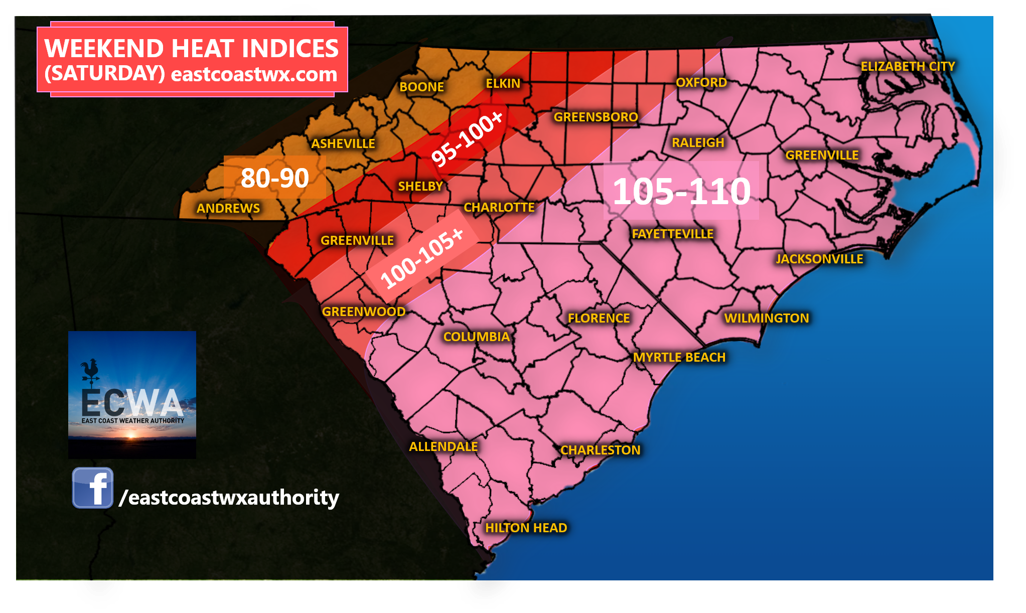
Saturday looks to be the worst of our heatwave with any rain chance more isolated and temperatures in the 80’s for the mountains, but well into the 90’s to near 100 for a lot of the Piedmont and the Coast. Heat indices will reach, if not exceed 100 in many areas. The eastern half of the Carolinas will sizzle in the worst of this heat with a few spots potentially approaching a heat index of 110 degrees! Take a look:
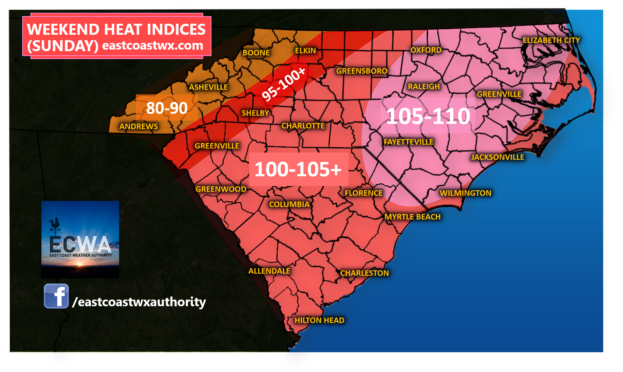
Sunday we will see very similar conditions to Saturday with any rain chance isolated, and the worst of our heat centered maybe a little to the north and east. Take a look at Sunday’s indices:
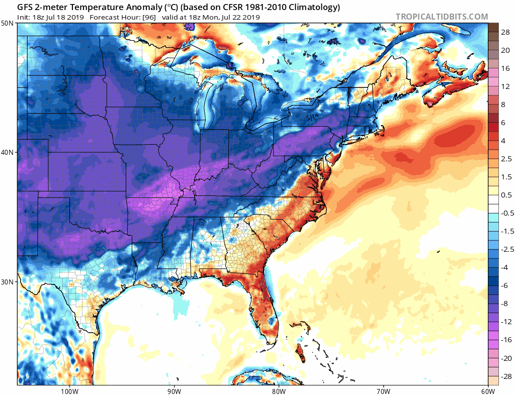
When does it end? Well there certainly is a light at the end of the tunnel for those longing for a relief from the brutality of this heat and it all begins early next week. However, with the cooler weather will come an increase in unsettled weather, at least initially, as a front sweeps southeast bringing heavy shower and thunderstorm activity later Monday into Tuesday. Take a look at the latest GFS projection of the front moving through later Monday into Tuesday:
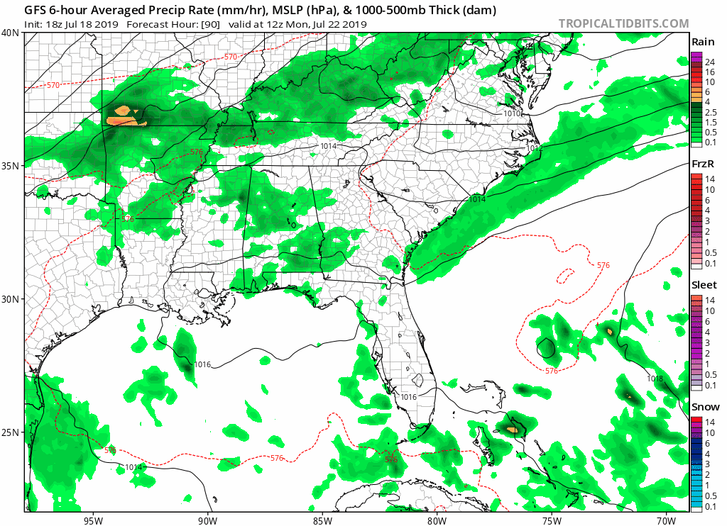
Oftentimes, a strong cold front moving through an areas that’s been baking in heat for several days leads to severe weather. We can likely at least expect some downpours and some risk of severe storms. We will watch and see how this plays out going forward. The front could stall for a time, which may allow some shower and thunderstorm activity to linger into late in the week for some areas.
Nevertheless, high temperatures will take a big tumble some 10 to 25 degrees beginning Tuesday and lasting through at least Thursday for most areas. Overnight lows will also take a noticeable decline to more reasonable levels for most. The Appalachian mountains could actually see low temperatures plummet into the 50’s by Thursday morning of this upcoming week with 60’s elsewhere! Daytime heating will still be mildly summer-like, but much less extreme than what we will experience this weekend. Take a look at how much our temperatures anomalys plunge next week as the trough digs into the Eastern US:
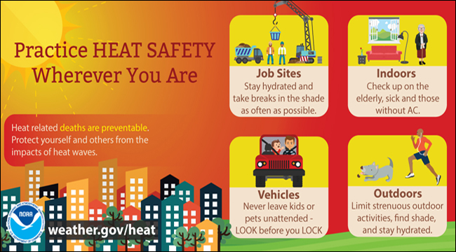
Before relief arrives this next week, you certainly don’t want to take this weekend heat lightly. Proper hydration, limiting your time outside, and pacing yourself in outside work and activities could be vital to your physical health and well-being and we encourage you to practice safety guidelines in the event of this heatwave.
The National Weather Service has a rather efficient set of safety guidelines available in the graphic below for you to examine:
Make sure to stay up to date with the latest here on the website, Facebook, and Twitter page. We will keep you informed.
-Jesse
East Coast Weather Authority
You must be logged in to post a comment.