
As we continue to keep an eye on the tropics the likelihood of tropical storm or even a hurricane making landfall in the southeast becomes more and more realistic. This is thanks to tropical storm Micheal which begins to show some intensification as it moves closer to the gulf.
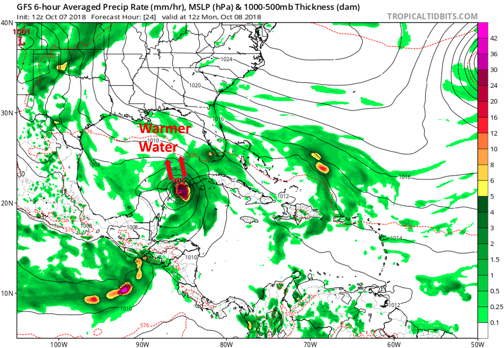
As the tropical storm Michael moves past Cuba through tonight and tomorrow morning, it will move into the warm waters of the gulf of mexico. As the storm does this it will rapidly intensify as it tracks northward towards Florida, Alabama, Mississippi, and Louisiana.
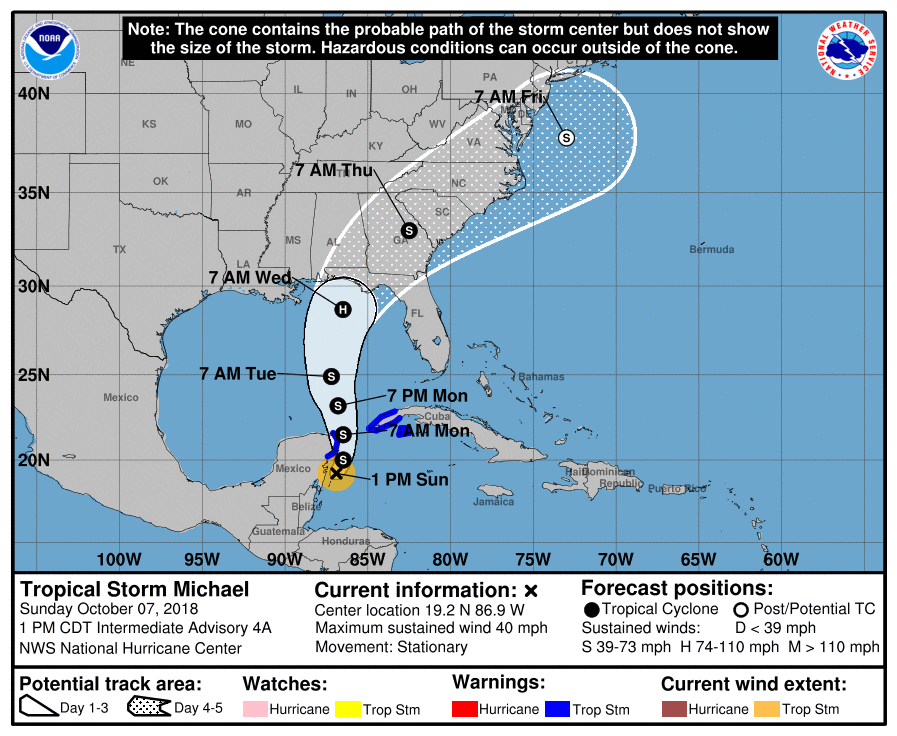
Looking at the most likely storm track, the storm could intensify into a hurricane before making landfall in Florida on Wednesday morning.
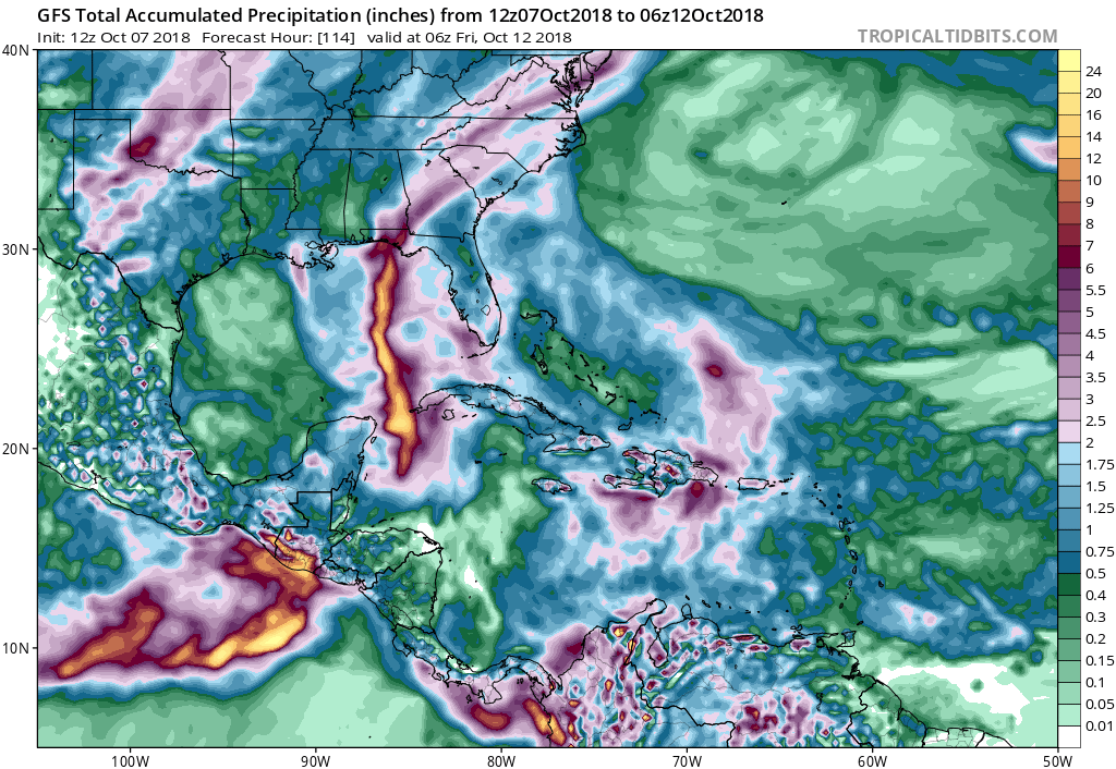
If this storm track holds true, the rainfall amounts wont be nearly as substantial as those seen in Florence however a majority of the southeast could see nearly 3-6 inches of rain. We will continue to closely watch the tropical storm as slight changes in the track and intensity are likely. Check back to East Coast Weather Authority for your latest update on weathers worst.
-Benjamin Charles
You must be logged in to post a comment.