
At 8:30 a.m., the National Hurricane Center named the disturbance we’ve been tracking off the Southeast Coast Tropical Storm Bertha, marking a rare instance where a second named tropical system formed before the official June 1 start of hurricane season.

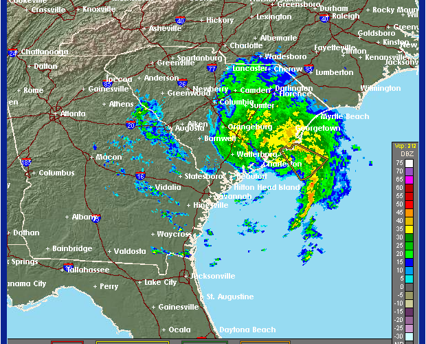
Maximum sustained winds of 45 mph are accompanying the storm, mostly in the band of thunderstorms east of the center. This band of storms will produce waterspouts and wind gusts of 60-65 mph as it come onshore near Georgetown around lunchtime and this afternoon.
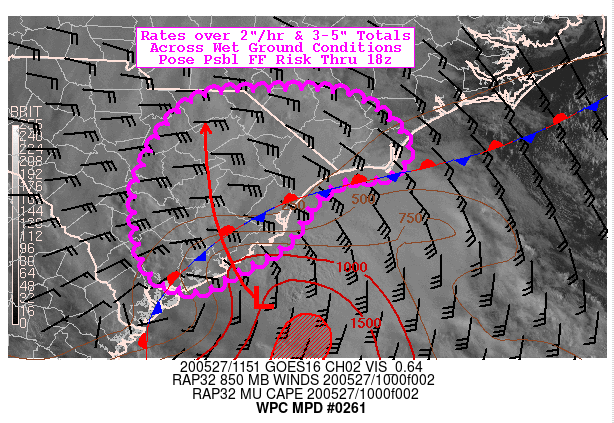
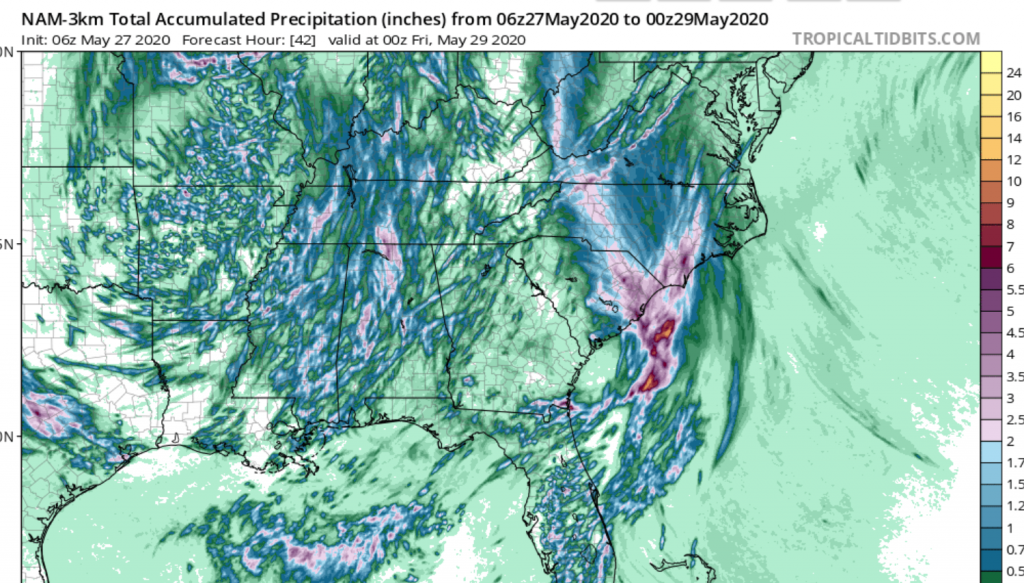
The big threat from this storm will be for flooding rainfall across the Carolinas today and tonight and then up into western Virginia overnight and early Thursday. Rain rates over 2 inches per hour are possible near the storm track through this afternoon, and we expect some flash flood warnings as the day wears on. Total amounts of rain of 2-4 inches will be common and the latest NAM-3 km model shows some potential for up to 8 inches in heavier bands near the coast. This will aggravate already swollen rivers across the Carolinas, and renews concerns for many who live on the Santee, Congaree, and Cape Fear Rivers, just to name a few.

In addition to the rain, the Storm Prediction Center has a marginal risk (2%) for severe wind and tornadoes near and to the east of Tropical Storm Bertha’s track, especially for coastal areas. A lot of these will come from that coastal band of storms about to move onshore.
Tropical Storm Bertha will weaken to a tropical depression a few hours after landfall this afternoon and track northwest towards Charlotte tonight as a remnant low. This will bring tropical rains northward across the Piedmont and up into the high country overnight. Be mindful of any watches and warnings that come from your NWS office and please turn around and don’t drown as nighttime flash floods are often deadly.
If you read our articles earlier this week, none of this should come as a surprise to you. But due to the time sensitivity of the upgrade from the National Hurricane Center, a lot escalated quickly. You read about the potential for this occurring here first, and we have your back at Carolina Weather Authority. And don’t forget to become a subscriber for even more content and discussion!
You must be logged in to post a comment.