
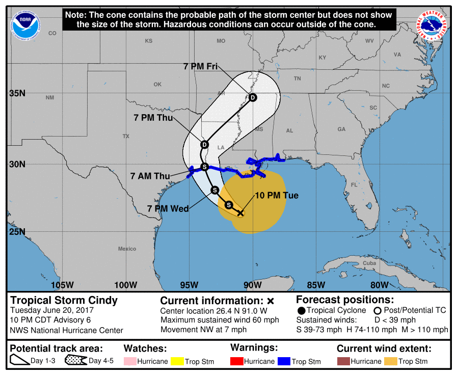
Tropical Storm Cindy will be more of a nuisance than anything. Not so much in the way of wind, but with the rains and flooding. Extremely heavy rain is falling tonight across New Orleans, and will continue to do so Wednesday as the system slowly pushes to the Northwest. The NHC has Cindy making landfall on the TX/LA border late Wedneday. This means a ton of rain for the Gulf Coast and the Southeast US. Lots of flooding is likely.
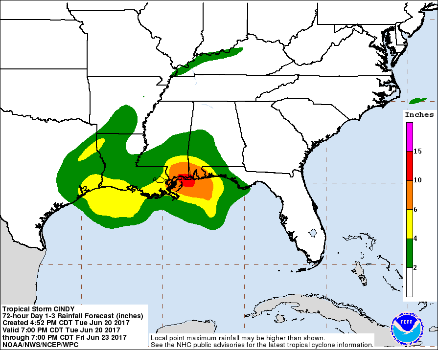
Speaking of flooding, New Orleans is under the gun for extreme amounts of rainfall from this storm. The WPC has projected that up to 13 inches + of rain could fall across the city. Elsewhere across the Gulf Coast, flooding is very likely. Do not drive into flood waters, the water may be deeper than you think. Turn around, don’t drown.
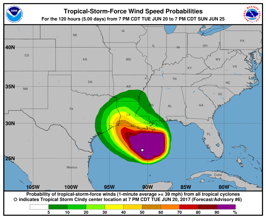
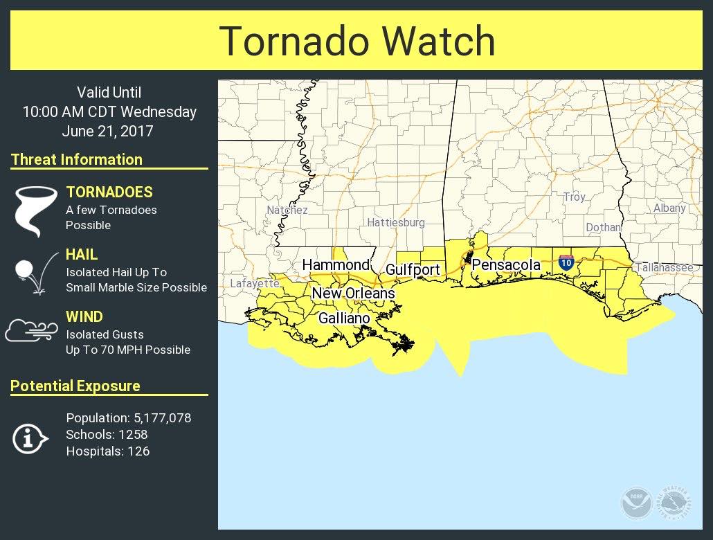
Tropical storm force winds will extend out beyond the center of the eye. Althought this is not an organized storm, any gusty winds will likely bring down trees and power lines due to the saturated ground. The highest probability for tropical storm-force winds is at the coast. With this wind threat comes the chance for tornadoes, and a Watch has been issued until 10 am Wednesday. The threat for tornadoes, however, will extend beyond that time.
Share this to inform family and friends using the buttons below!
You must be logged in to post a comment.