
TROPICAL STORM JERRY EXPECTED TO STRENGTHEN TO HURRICANE BY FRIDAY
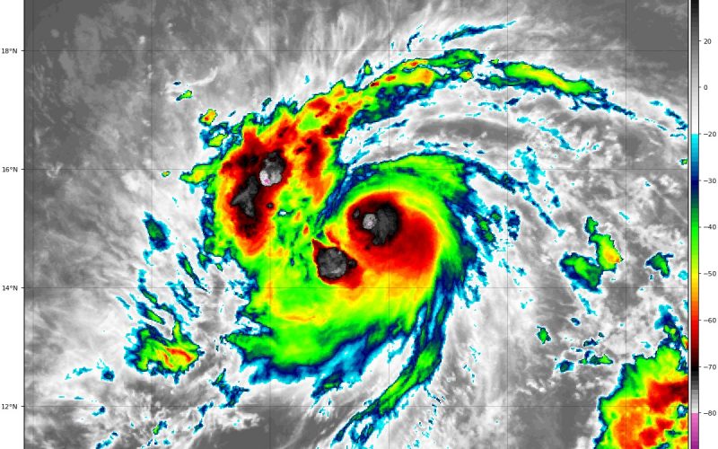
Tropical Storm Jerry has formed in the Atlantic, and is expected to strengthen to a category 1 hurricane by Friday. Jerry will likely graze the eastern side of the Leeward Islands, though the center should stay north, leaving that area with some tropical storm conditions for a short time.
Furthermore, a weakness in the ridge left behind by Humberto, will allow a pathway for Jerry to venture as a re-curving of the cyclone is expected just prior to reaching the Bahamas. More shear, and a less favorable environment will likely weaken Jerry from a hurricane back to a tropical storm. With all of this in consideration, this will allow impacts (if any) on the eastern side of the Bahamas to be fairly minor and tolerable, and the western portion of the islands to remain unscathed. Furthermore, Jerry should track northeastward from there, with no threat to the East Coast. Here’s the latest outlook from The National Hurricane Center:
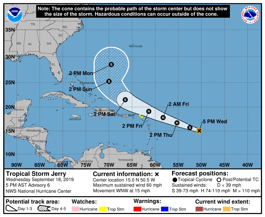
However, we continue to monitor the potential for changes in the forecast track of Jerry, as we are still early in the evolution of this cyclone, and some changes cannot be ruled out. Remember as we’ve been saying; we’re watching the end of September into October for more potential tropical threats to the East Coast, be it formation in the Gulf or the Caribbean.
Make sure to stay tuned to Carolina Weather Authority for the latest tropical updates on our Facebook and Twitter pages, and here on the site. Also make sure to check out our latest models page where you can follow along with updates from the National Hurricane Center and forecast modeling at your personal convenience.
-Jesse
Carolina Weather Authority
You must be logged in to post a comment.